


I. A Mongol Khan Hands a Monk the World
There is a peculiar founding myth at the heart of Tibetan political modernity, one that tends to get smoothed over in both sympathetic and hostile accounts of the period. In 1642, Güshi Khan — a Khoshut Mongol chieftain who had spent the previous decade consolidating military dominance over the Tibetan plateau by defeating the Beri king of Kham and then the Tsangpa rulers of central Tibet — handed temporal authority over the country to Ngawang Lobsang Gyatso, the Fifth Dalai Lama. The state that resulted, the Ganden Phodrang, is sometimes described as a theocracy, sometimes as a monastic government, sometimes as a Tibetan national institution. All of these are partially true, and all of them obscure the founding paradox: the most distinctively Tibetan political institution of the modern era was inaugurated by a Mongolian general who remained its nominal sovereign for decades afterward.
I want to sit with that paradox rather than dissolve it, because it is what makes 1642 genuinely interesting — and because it is what this map is, at its core, trying to hold in suspension.

Güshi Khan and the Fifth Dalai Llama (source)
II. What the Map Argues
The map I have made does not present Tibet as a modern nation-state with clearly demarcated, uniformly administered territory. That would be anachronistic and historiographically untenable. What it presents instead is a moment of institutional crystallization: the point at which a governing center — Lhasa, the Ganden Phodrang, the fused authority of the Fifth Dalai Lama — became durable enough to organize political space across the plateau in a recognizable and lasting way.
The red perimeter line marking consolidated authority is deliberately graduated rather than uniform. It is heavier and more defined around Ü-Tsang, the central regions where Ganden Phodrang administrative reach was densest. It softens toward the east, toward Amdo and Kham, where authority was exercised through networks of monastery patronage and aristocratic allegiance rather than direct bureaucratic administration. This is not a cartographic imprecision — it is an argument. The Ganden Phodrang governed through layered, negotiated relationships, not through the kind of territorial sovereignty that European cartographic conventions tend to imply.
Looking at the map itself, much of the visual weight comes from the Tibetan script distributed across the interior. The large golden characters at center read simply Bod — Tibet — rendered in dbu-can, the formal upright script associated with monastic and administrative texts. The surrounding place names — Amdo in the northeast, Kham in the east, Ladakh to the west, the Himalayan kingdoms along the southern edge — are written in the same hand, asserting a spatial order through language before topography is even considered. The ornamental border, drawn from seventeenth- and eighteenth-century manuscript illumination, frames the political space within an aesthetic tradition. The map looks like a document because, in a meaningful sense, it is one.

1940 Tibetan World Map (source)
III. The Fifth Dalai Lama and the Problem of Legitimacy
Güshi Khan's military intervention solved one problem and created another. It eliminated the Tsangpa rulers, who had been hostile to the Gelug school, and installed the Fifth Dalai Lama as the supreme religious and temporal authority in Tibet. But it also made the new government immediately dependent on Khoshut military power for its survival. The Fifth Dalai Lama spent much of his subsequent career navigating that dependency with extraordinary political skill — cultivating relationships with the Qing dynasty, managing the internal politics of the Gelug hierarchy, and projecting an image of sovereignty that, over time, gradually became substantive rather than merely symbolic.
This matters for cartographic representation because the territory this map depicts was not uniformly or straightforwardly "governed" by Lhasa in 1642. It was a landscape of competing and overlapping jurisdictions — monastic estates, aristocratic lineages, regional polities, Mongol military presence — that the Ganden Phodrang was in the process of organizing, not one it had already mastered. The map tries to show the beginning of that process, not its completion.
Historians like Samten G. Karmay and Matthew Kapstein have demonstrated that the Ganden Phodrang was a real governing institution with measurable administrative reach — it collected taxes, managed land tenure, conducted diplomatic relations. Tsepon W.D. Shakabpa's political history traces its durability across centuries. What the scholarly consensus does not support is the image of a modern territorial state with neat borders and uniform sovereignty. The Ganden Phodrang governed the way most pre-modern polities governed: unevenly, through intermediaries, with the density of control declining sharply as distance from the center increased.

Snow Lion at Potala Palace
IV. Making the Map: Constraint as Method
There is no seventeenth-century territorial map of Tibet that survives in a form comparable to contemporary European cartography. What survives instead are cosmological diagrams, pilgrimage charts, monastic estate records, and narrative histories rich in geographic description but resistant to the kind of spatial precision modern cartography assumes. This absence shaped every decision I made.
The calligraphic dimension was the most demanding element. High-quality Tibetan digital typefaces are limited, and many available fonts flatten the dynamic stroke variation characteristic of dbu-can and its cursive counterpart dbu-med. The formal inscriptions visible on this map were cross-checked against digitized archival scans and manuscript exemplars to approximate seventeenth-century orthographic conventions. Several regional names required philological attention, since modern transliteration standards do not always correspond to early modern usage.
The ornamental border draws directly from seventeenth- and eighteenth-century manuscript illumination: corner flourishes, layered pigments, and framing conventions drawn from illuminated folios and thangka compositions. Tibetan scribal culture historically relied on iterative copying as a form of preservation: reproduction was how texts survived. In choosing to work within that aesthetic grammar rather than against it, I was trying to situate the political argument within an indigenous visual tradition, to make the map look like it belongs to the world it depicts rather than looking down on it from outside.
One reference point I found particularly valuable was the work of Tashi Mannox, whose Tibetan Calligraphy Collective piece — executed in natural mineral paint, iron-gall ink, and pure gold leaf on Bhutanese Desho paper — captures the full range of Tibetan scribal registers, from formal dbu-can through the cursive umé hand. The diversity of that tradition is easy to underestimate if you approach Tibetan script only through digital fonts.
I want to be honest about what I am not. I am not a trained Tibetan calligrapher, and this map does not claim calligraphic mastery. What it claims is historical plausibility and internal consistency — a modern interpretive hand working from archival precedent toward a rendering that respects rather than domesticates the tradition it is trying to represent.

Illuminated Folio of the Sutra Manuscript, Tibet, 15th century (source)
V. The Map Enters the World
In 2023, this map was referenced in a Tibetan-language article by Radio Free Asia examining the geopolitical significance of historical cartography in contemporary discourse about Tibet. The article — which included an interview with Tsering Wangyal, head of the Geospatial Information Section at Princeton University's library — discussed how reconstructions of early modern Tibetan political space circulate in current debates about legitimacy, autonomy, and territorial continuity.
I did not make this map as a geopolitical intervention. My intention was historical: to visualize a specific institutional moment in seventeenth-century Inner Asia as rigorously and honestly as I could. But I have thought seriously about what it means that the map was taken up in that context, and I no longer think the distinction between historical and political purpose is as clean as I once assumed.
Any map of Tibet is political. Not because the cartographer chooses to make it so, but because the question of what Tibet was — administratively, territorially, institutionally — remains genuinely contested in ways that make historical visualization inherently argumentative. When I render the Ganden Phodrang's authority as graduated rather than uniform, that is a historical judgment that happens to be in tension with the totalizing territorial claims made by the People's Republic of China. When I write Bod in golden dbu-can at the center of the composition, that is an assertion about what kind of entity this was and whose visual tradition it belongs to.
I did not set out to make those arguments polemically. But I made them. The RFA article made that visible in a way I found instructive. As Tsering Wangyal's work at Princeton suggests, the archival and cartographic record of Tibetan history is itself a contested domain — underrepresented in global discourse relative to state-produced cartography, unevenly digitized, dispersed across institutions in India, Nepal, Europe, and China. Making this map was a small participation in that larger effort to make Tibetan historical production visible.
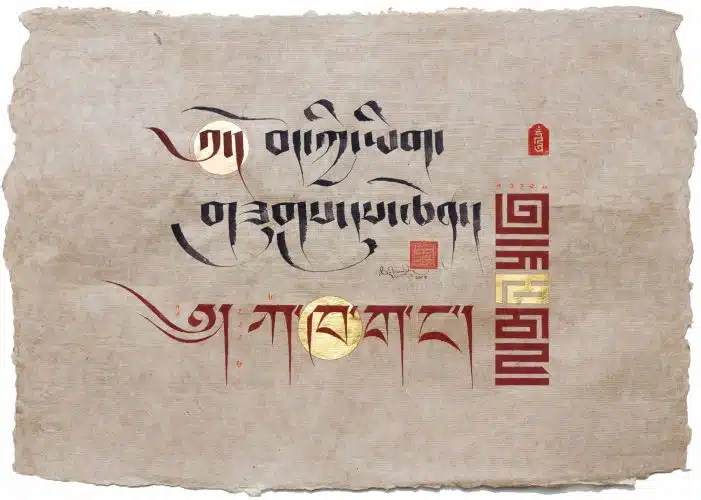
Tibetan Calligraphy, 2019 (source)
VI. What 1642 Means
The Ganden Phodrang survived, in various forms, until 1959. That is three centuries of institutional continuity — a remarkable achievement for any governing structure, and particularly for one born under the circumstances of 1642: military imposition, political fragmentation, religious contestation. Its durability owed much to the genius of the Fifth Dalai Lama, much to the organizational capacity of the Gelug monastic system, and much to the adaptive flexibility of a government that never fully centralized authority but managed instead to hold a vast and varied landscape in sustainable alignment.
I have tried to show the beginning of that story: the moment when the alignment became stable enough to map. Not a nation-state, not an empire, not a satellite — but a governing center whose legitimacy was religious, whose military foundation was Mongol, and whose administrative reach was uneven and negotiated.
The map does not resolve the contradictions of 1642. It holds them. That is what I wanted it to do.
Bibliography (Selected)
Karmay, Samten G. The Arrow and the Spindle: Studies in History, Myths, Rituals and Beliefs in Tibet. Kathmandu: Mandala Book Point, 1998.
Kapstein, Matthew T. The Tibetans. Oxford: Blackwell, 2006.
Schaeffer, Kurtis R. The Culture of the Book in Tibet. New York: Columbia University Press, 2009.
Shakabpa, Tsepon W.D. Tibet: A Political History. New Haven: Yale University Press, 1967.
Shakya, Tsering. The Dragon in the Land of Snows: A History of Modern Tibet Since 1947. London: Pimlico, 1999.
Sneath, David. The Headless State: Aristocratic Orders, Kinship Society, and Misrepresentations of Nomadic Inner Asia. New York: Columbia University Press, 2007.
Van Schaik, Sam. Tibet: A History. New Haven: Yale University Press, 2011.
Cartographic and Archival Sources
- Tibetan World Map, 1940 — Church of Scotland Guild collection, AbeBooks reference
- Tashi Mannox, Tibetan Calligraphy Collective (2019), natural mineral paint and iron-gall ink on Bhutanese Desho paper. tashimannox.com
- Radio Free Asia Tibetan Service, "The Geopolitical Importance of Cartography to Demarcate National Boundary" (August 2023), featuring interview with Tsering Wangyal, Princeton University Library. rfa.org
- Utsang Culture resource materials. utsangculture.com