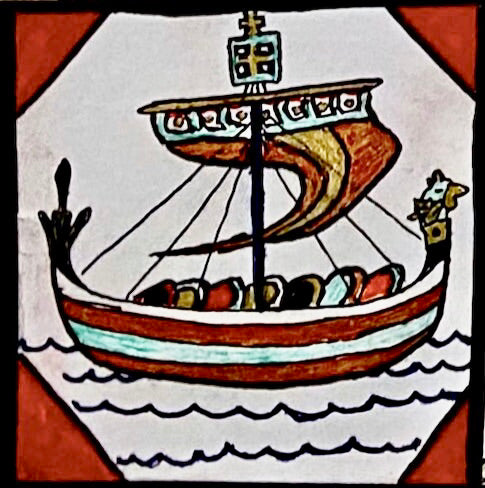


This document accompanies the hand-painted map of the Viking Age (c. 793 to 1066) and describes the research, methodology, and cartographic decisions behind it. The map renders every place name in Younger Futhark runes, reconstructed to approximate Old Norse phonology rather than modern Scandinavian spelling. What follows is intended to make that reconstruction, and the choices behind it, legible to a reader without a background in Old Norse or runology.
Method of Place Name Reconstruction
Each place name on the map passed through three stages of research, recorded systematically in a working notebook organized by region and color-coded by source category. For every location, the notebook records the contemporary English name, its corresponding Old Norse form, and the Younger Futhark transliteration of that form. Constantinople, for instance, appears as Miklagarð, rendered in its full nominative form as Miklagarðr, and finally transliterated as ᛘᛁᚴᛚᛅᚴᛅᚱᚦᚱ. Limerick appears as Hylmrek, rendered as Hylmrekr, and transliterated as ᚼᚢᛚᛘᚱᛁᚴᛦ. This structure was maintained across over one hundred place names, from major cities to minor coastal settlements, so that each stage of the reconstruction could be checked independently against sources before being committed to the final composition.

The Old Norse forms were established primarily through the Old Norse and Germanic dictionary maintained by the Germanic Lexicon Project, cross-referenced against the Zoëga and Cleasby-Vigfusson dictionaries. Where an attested medieval form existed, whether from skaldic poetry, saga literature, or a runic inscription, that form was given priority over a modern philological reconstruction. Miklagarð, Kænugarðr for Kiev, and Holmgarðr for Novgorod are examples of well-attested period terms that appear repeatedly across saga sources describing the eastern trade routes and the Byzantine Varangian Guard. Other names required more reconstruction from etymological principle, informed by the Germanic Lexicon Project entries and by the list of Old Norse exonyms maintained on Wikipedia, particularly for smaller settlements in the British Isles and Iberia with less saga attestation.
Transliteration into Younger Futhark followed the guide published by vikingrune.com, supplemented by direct study of surviving runic inscriptions catalogued by the Swedish National Heritage Board's Runor database and the Skaldic Poetry of the Scandinavian Middle Ages project. Younger Futhark uses sixteen runes to represent a phonemic inventory considerably larger than sixteen sounds, meaning a single rune frequently stands for more than one related consonant or vowel. Rather than resolving this ambiguity for the sake of modern clarity, the map preserves it, consistent with the orthographic practice attested on actual Viking Age runestones.
The Codex Runicus, a thirteenth century Danish legal manuscript held by the University of Copenhagen, served a more specific purpose in this project. It is one of the only surviving manuscripts to render extended prose passages, rather than short inscriptions, entirely in runes. It was used here primarily as a model for writing continuous runic text and for punctuation conventions in Old Norse, most directly applied in the transcription of the Hávamál passages that appear on the map. Short runestone inscriptions rarely demonstrate how a scribe punctuated or divided longer runic prose, which made the Codex Runicus a useful reference specifically for this purpose.
The Hávamál excerpt itself is drawn from the Poetic Edda, a collection of Old Norse verse traditionally attributed to the voice of Odin. The transcription draws on the Old Norse text maintained by the University of Pittsburgh and on the published lectures and translations of Jackson Crawford, a specialist in Old Norse whose teaching and public lectures were used throughout this project to verify grammar, meter, and pronunciation.
Cartographic Conventions
The map distinguishes Scandinavian homeland territory from settled or conquered territory by shade. Darker blue marks Norway, Sweden, and Denmark, the political and cultural core of the Norse world. Lighter blue marks regions that came under Norse settlement or control during the period, including the Danelaw, Normandy, the Irish coastal settlements centered on Dublin, Iceland, and the Greenland settlements founded in the late tenth century at sites including Brattahlíð and Herjólfsnes.
Route lines are distinguished by color and direction. Red lines mark trade routes, including the river networks of the Dnieper and Volga through the territory the Norse called Garðaríki, the land of the Rus' city states, extending toward Miklagarð and, further east, toward Serkland, the Norse term for the lands of the Abbasid Caliphate reached via Caspian trade routes. Blue lines mark raiding routes, including passages up the Seine toward Paris, along the English and Frankish coasts, and into Iberia and the western Mediterranean.
The map's westward extent follows the Norse expansion across the North Atlantic, from Iceland to Greenland and onward to the North American coast. Three saga place names appear along this coastline: Helluland, likely corresponding to Baffin Island, Markland, likely corresponding to the Labrador coast, and Vinland, the southernmost of the three, where the Leifsbúðir camp corresponds to the archaeological site at L'Anse aux Meadows in Newfoundland.
A number of other period geographic terms appear on the map and are worth noting for readers unfamiliar with Old Norse geography. Grænland, the Old Norse name for Greenland, is generally understood by historians to have been a deliberately favorable name chosen to attract settlers. Blaland, literally "blue land," was the Norse term for parts of Africa known indirectly through southern trade networks.

Editorial Decisions and Limitations
A finished map inevitably requires judgment calls that a short accompanying text can make more transparent than the map itself. Brittany is currently marked using the same shading applied to sustained Norse territories such as Normandy and the Danelaw. This overstates the historical record. Norse activity in Brittany during the ninth and tenth centuries consisted of raiding and short term occupation rather than lasting territorial control, and this is a correction intended for future printings.
Estonia is marked in the same dark blue used for the Scandinavian homelands, rather than the lighter blue used for settled or conquered territory. This reflects a deliberate distinction rather than an oversight. The raiding culture centered on the Estonian coast, particularly the island of Saaremaa, during the Viking Age was substantial and well documented, including a significant raid on Sigtuna in Sweden in 1187. These raiders were not Norse Scandinavians. They represent a separate, parallel maritime raiding tradition operating within the same period and within the broader historical sense of the term Viking. The map treats this Baltic raiding culture as a point of origin in its own right, comparable in status to the Scandinavian homelands, rather than as territory acted upon by an outside power.
Rügen Island does not appear marked on the map. Norse-Slavic conflict involving Rügen is better documented in later medieval sources, and no reliable evidence was found to support Viking Age occupation or settlement of the island during the period this map represents. It was therefore left unmarked rather than included on uncertain grounds.
Sources
Old Norse language and lexicography
- Germanic Lexicon Project, Old Norse-English Dictionary (primary lexical source): http://www.germanic-lexicon-project.org/search/aa_search.html
- Zoëga, A Concise Dictionary of Old Icelandic: https://norse.ulver.com/dct/zoega/g.html
- Cleasby-Vigfusson Old Norse Dictionary: https://cleasby-vigfusson-dictionary.vercel.app/search?query=oxford&criteria=all
- List of Old Norse Exonyms, Wikipedia: https://en.wikipedia.org/wiki/List_of_Old_Norse_exonyms#L
- Skaldic Poetry of the Scandinavian Middle Ages, place name database: https://skaldic.abdn.ac.uk/m.php?p=onwplaces
Runology and runic inscriptions
- Codex Runicus, Wikipedia overview: https://en.wikipedia.org/wiki/Codex_Runicus
- Codex Runicus, digitized manuscript, University of Copenhagen: https://www.e-pages.dk/ku/579/
- Nottingham Runic Dictionary: http://runicdictionary.nottingham.ac.uk/dictio.php
- Swedish National Heritage Board, runic inscription database: https://app.raa.se/open/runor/search_results
- Skaldic Poetry of the Scandinavian Middle Ages, runic inscriptions: https://skaldic.abdn.ac.uk/db.php?if=runic&table=nrd_headword&val=A
- Runinskrifter.net, runic inscription clusters: https://www.runinskrifter.net/clusters
- Dietrich, Runensprachschatz (archival text): https://archive.org/details/runensprachschat00diet/page/n13/mode/2up?view=theater&q=Schweden
- Viking Rune, guide to writing in Younger Futhark: https://www.vikingrune.com/write-in-futhark-runes-old-norse-guide/
Hávamál and Old Norse literature
- Hávamál, Old Norse text, University of Pittsburgh: https://sites.pitt.edu/~dash/havamal.html
- Jackson Crawford, Old Norse language resources and lectures: https://jacksonwcrawford.com/
- Jackson Crawford, Hávamál lecture: https://www.youtube.com/watch?v=LYmxCAhf86o
Geography and historical context
- Scandza, Wikipedia: https://en.wikipedia.org/wiki/Scandza
All translations, transliterations, and interpretive decisions are the author's own, and any errors are as well.