


CartographyCraft
Carolingian Empire under Charlemagne — A Map in Carolingian Minuscule
Carolingian Empire under Charlemagne — A Map in Carolingian Minuscule
Couldn't load pickup availability
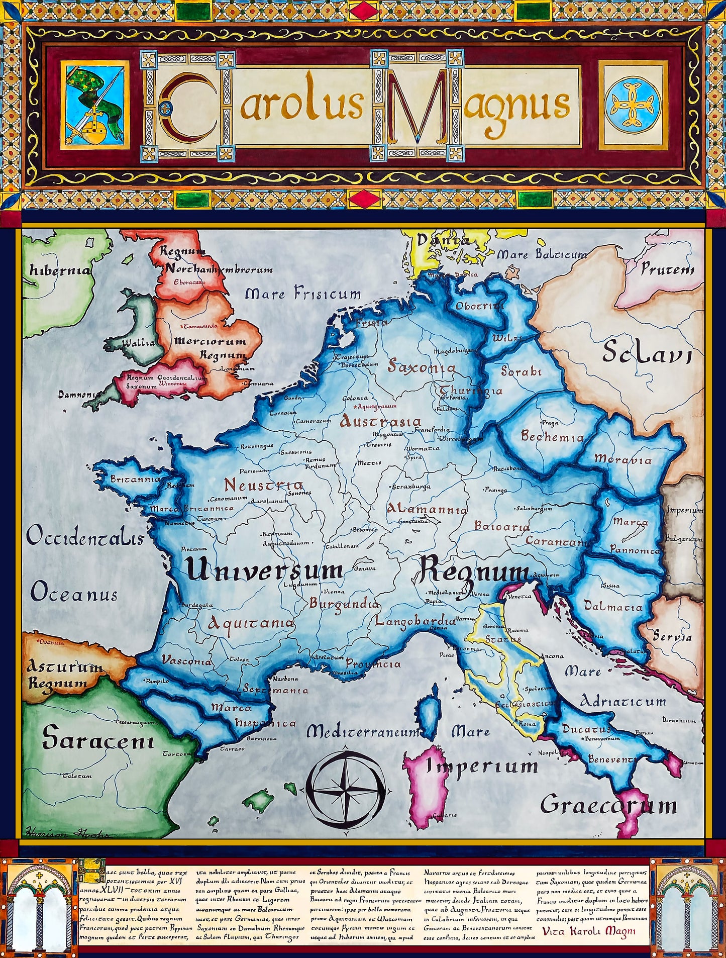
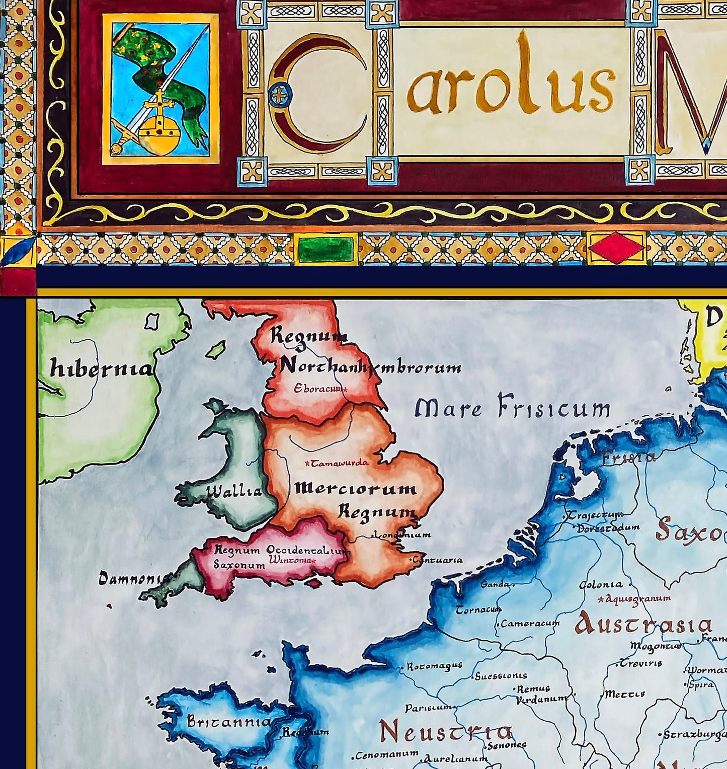
Hand-painted and historically researched map of the Carolingian Empire in the early ninth century, depicting the realm forged under Charlemagne and his immediate successors. All text is written in Medieval Latin, rendered in Carolingian minuscule, the script promoted by Charlemagne’s court as part of a broader program of administrative, educational, and cultural reform.
The Frankish empire is shown within its wider geopolitical context. To the north lie Viking raiders along the North Sea and Atlantic coasts; to the south, Muslim polities in Iberia and the Mediterranean; and to the east, Slavic peoples beyond the empire’s frontier. In Italy, the Byzantine Empire retains control of portions of the south, while the Papal States, newly established following the Donation of Pepin, emerge as a distinct political entity. Across the Channel, the Anglo-Saxon kingdoms of Britain remain politically fragmented.
Often described as the “Father of Europe,” Charlemagne laid the institutional and ideological foundations for what would later become the Holy Roman Empire. This map captures a rare moment of relative unity in Western Europe before the fragmentation of the Carolingian realm later in the ninth century. Interested in more? Click here.
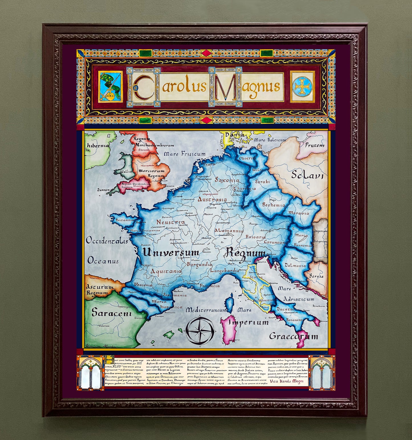
This work is available as a high-quality giclée print in multiple sizes. Fine details may appear softened in online images due to compression; the printed version is significantly clearer.
This map was researched and hand-painted by a trained historical cartographer with academic experience in European and global history. Each CartographyCraft map is designed to prioritize historical accuracy, visual clarity, and period-appropriate aesthetics over modern anachronism. If you are interested in a print with a frame or the original, contact the site owner directly.

-
Shipping
Maps are shipped sealed in a tube via UPS, USPS, and FedEx. Please allow up to 2 weeks for your map to arrive.
-
Return Policy
Not happy with the product? Full refund on returns up to 30 days after purchase.