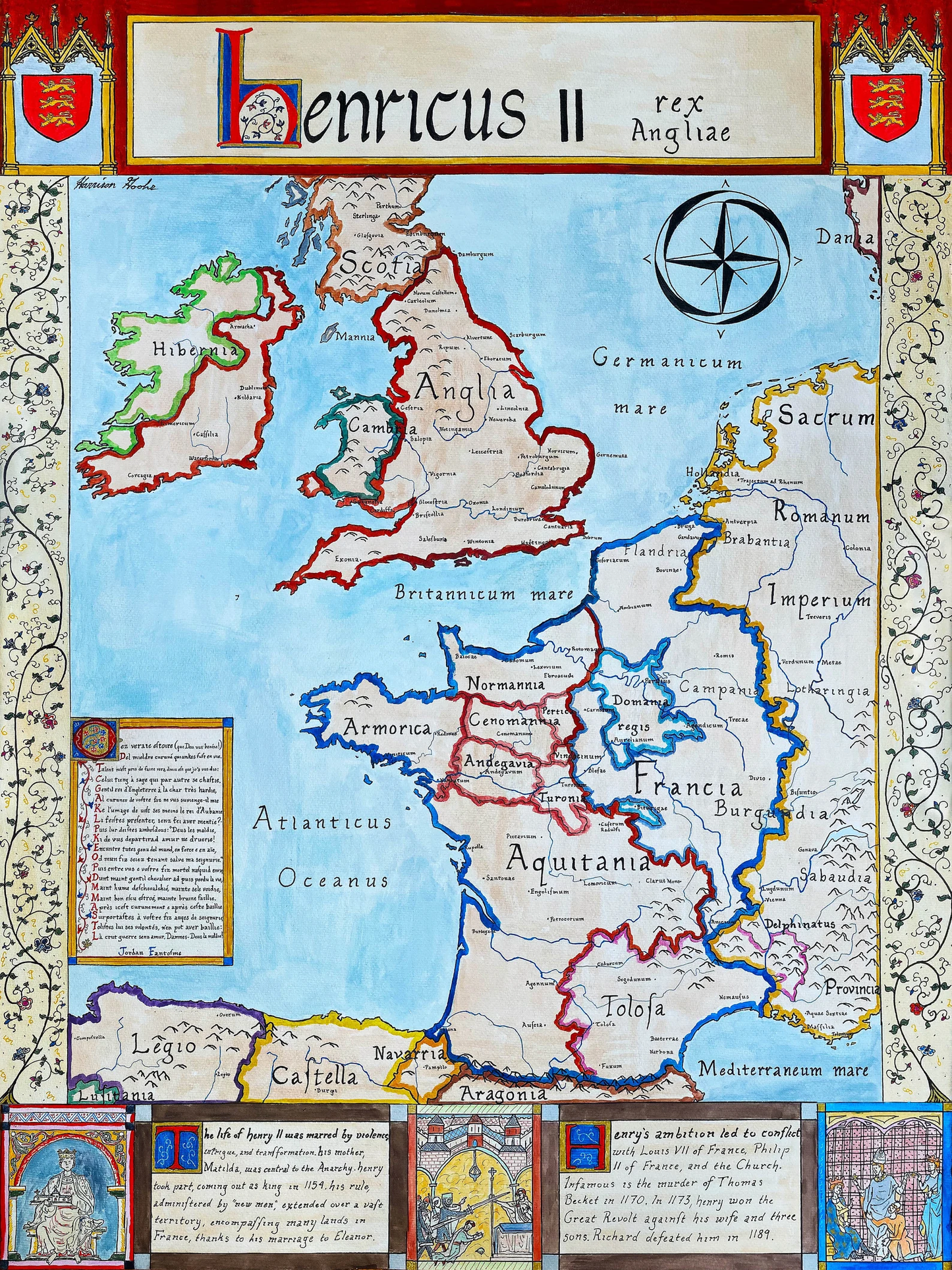
Hand-painted and researched map of Western Europe during the reign of King Henry II (r. 1154–1189), representing the territorial constellation commonly described by historians as the Angevin Empire.
Rather than a centralized empire in the Roman sense, the Angevin dominion was a dynastic composite: a network of feudal lordships united through inheritance, marriage, and conquest. Under Henry II of the Plantagenet house, authority extended from the Duchy of Aquitaine in the south to the Lordship of Ireland and intermittent claims in Scotland, encompassing England, Normandy, Anjou, Maine, and vast territories in western France. The map emphasizes this political fragmentation, distinguishing between direct control, feudal allegiance, and contested regions.
The County of Toulouse is shown as claimed by Henry yet functionally autonomous, reflecting the limits of Angevin authority. The Capetian monarchy, centered in Paris, appears territorially modest but politically resilient—poised to exploit the structural weaknesses of Angevin overextension in the decades following Henry’s death.
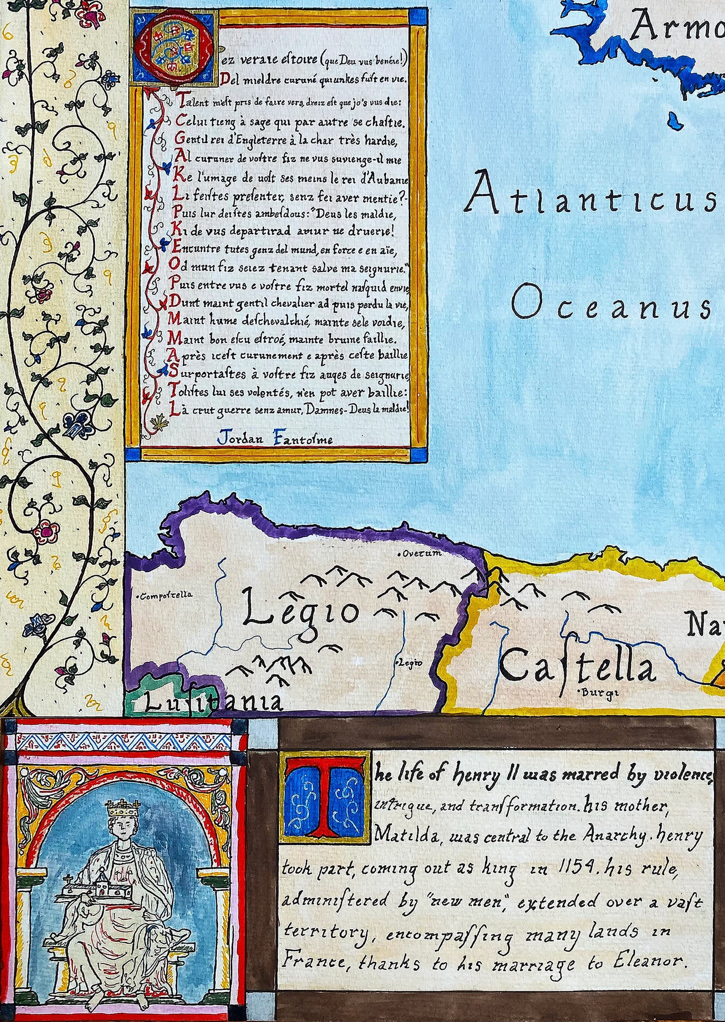
Toponyms are rendered in Medieval Latin using a Carolingian minuscule hand to evoke twelfth-century manuscript culture. A contemporary poetic excerpt is incorporated to situate the map within the intellectual world of the High Middle Ages. Supplementary English annotations provide modern clarification without disrupting the period aesthetic. Select manuscript-style illustrations reference notable events of Henry’s reign, reinforcing the fusion of cartography and historiography.
This work presents the Angevin realm not as an anachronistic nation-state, but as a fluid feudal structure defined by personal lordship, dynastic legitimacy, and layered sovereignty—central characteristics of twelfth-century Western European political order.
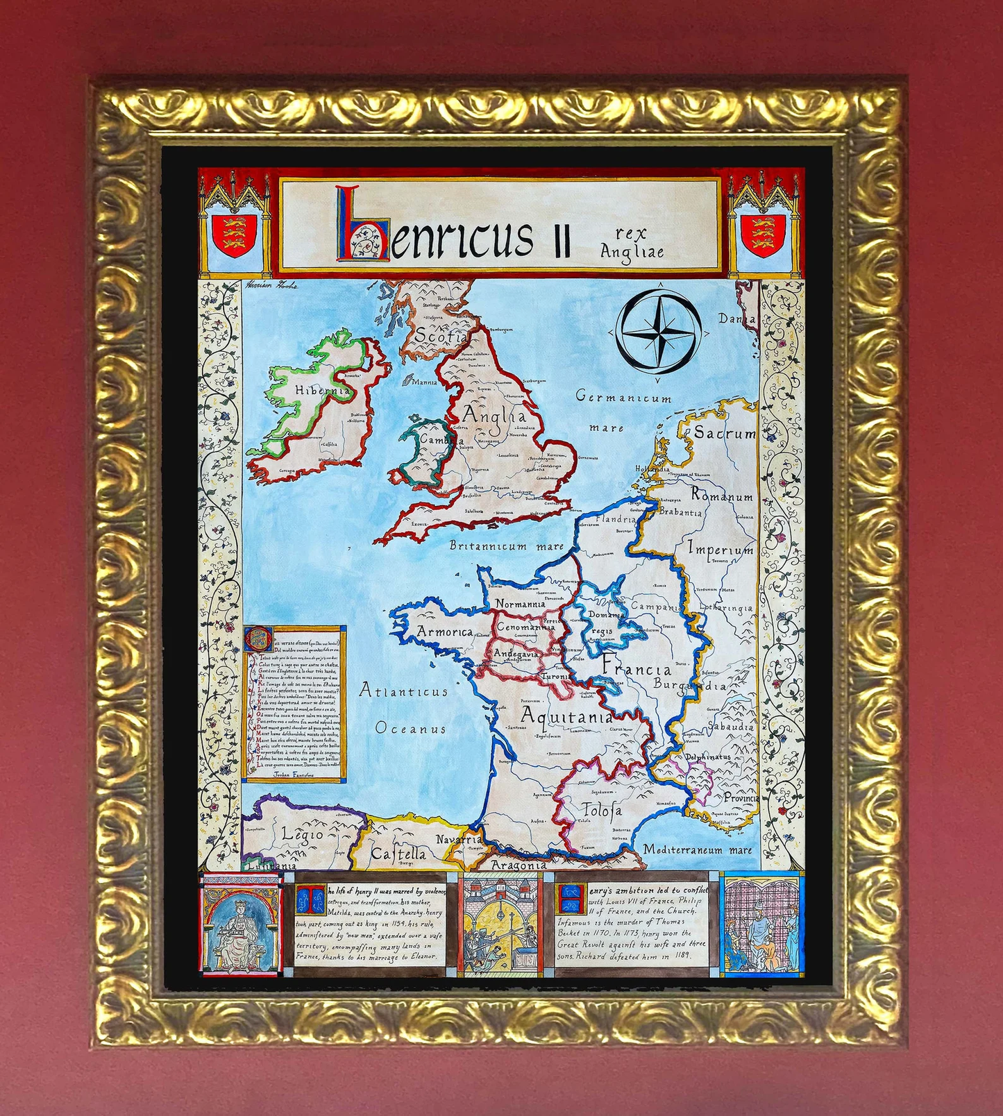
High-quality giclée print available in multiple sizes. The printed version preserves greater clarity and detail than compressed online images.
This map was researched and hand-painted by a trained historical cartographer with academic experience in European and global history. Each CartographyCraft map is designed to prioritize historical accuracy, visual clarity, and period-appropriate aesthetics over modern anachronism. If you are interested in a print with a frame or the original, contact the site owner directly.