


CartographyCraft
Kievan Rus Map c. 1200 – Medieval Eastern Europe in Old East Slavic
Kievan Rus Map c. 1200 – Medieval Eastern Europe in Old East Slavic
Couldn't load pickup availability
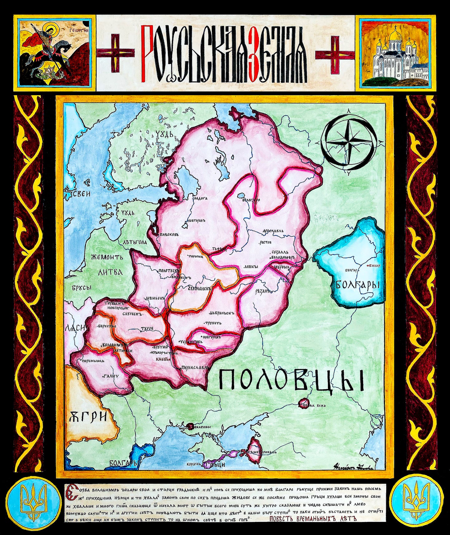
Hand-painted and researched map of Kievan Rus around the year 1200, during the era of dynastic fragmentation following its political zenith.
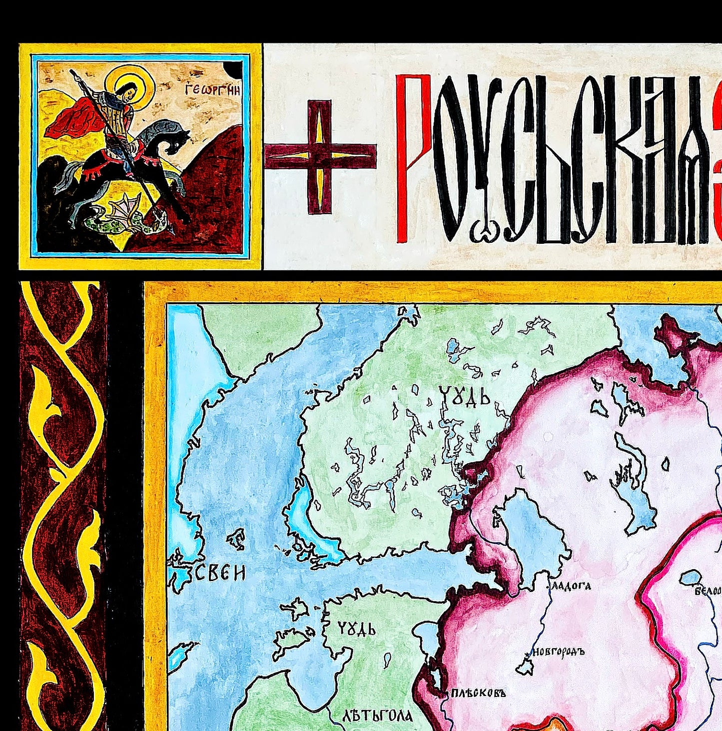
The map is written in Old East Slavic and Old Church Slavonic, modeled on the orthography of the Primary Chronicle. The title is rendered in the ornate vyaz calligraphic style associated with medieval Slavic manuscript culture. A passage from the Primary Chronicle recounting the baptism of Vladimir the Great of the Rurikid dynasty and the Christianization of Rus’ is reproduced at the bottom, situating the map within its ecclesiastical and literary tradition.
Political boundaries represent scholarly reconstructions of the principalities of Rus’, including Kiev, Vladimir-Suzdal, Galicia-Volhynia, Novgorod, and others during the period preceding the Mongol invasions. The composition emphasizes the decentralized nature of authority in the twelfth century rather than projecting later Russian or Ukrainian state borders backward in time.
Iconographic elements further anchor the work in medieval Slavic tradition: Saint George appears in the upper left, modeled after early iconographic conventions, while the upper right references the Dormition Cathedral in Vladimir, one of the architectural monuments of the northeastern principalities.
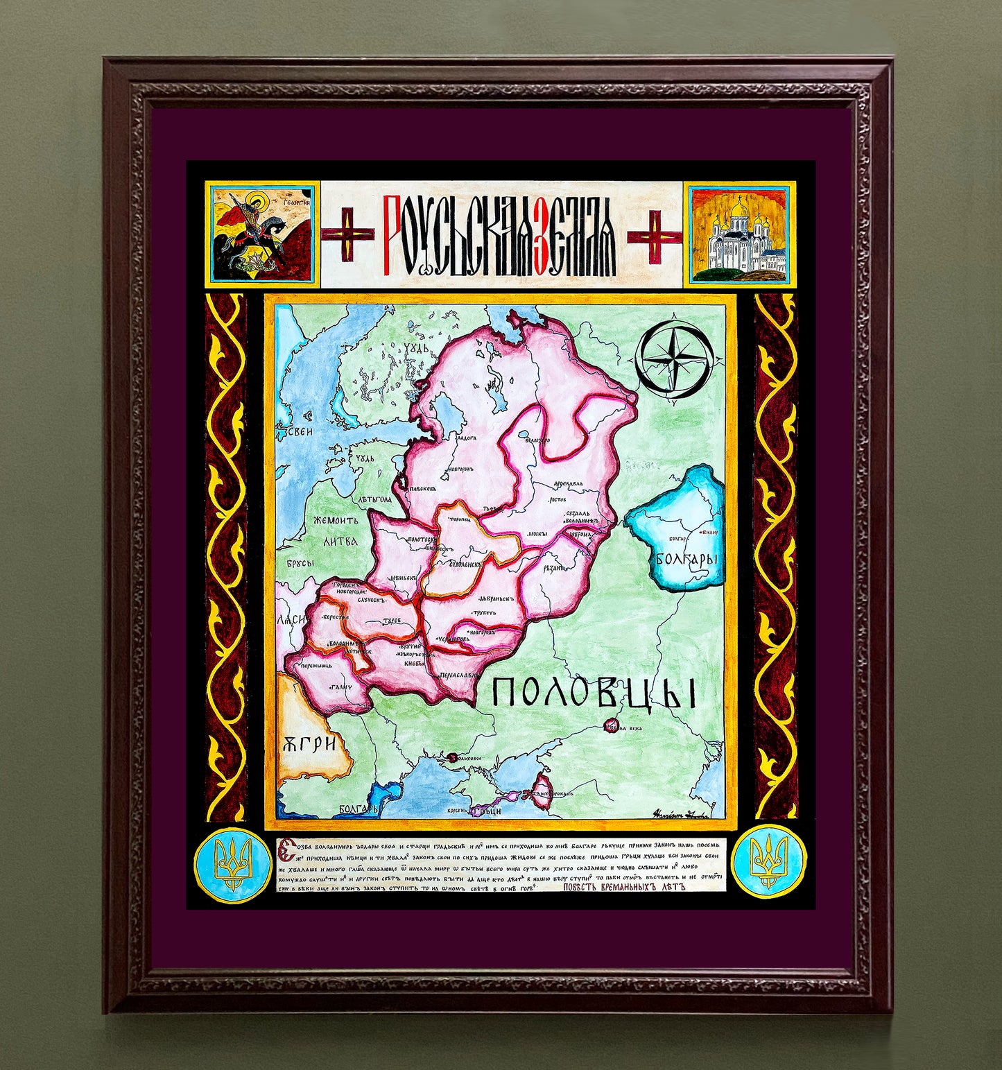
High-quality giclée print available in multiple sizes. The printed version preserves greater clarity and detail than compressed online images.
This map was researched and hand-painted by a trained historical cartographer with academic experience in European and global history. Each CartographyCraft map is designed to prioritize historical accuracy, visual clarity, and period-appropriate aesthetics over modern anachronism. If you are interested in a print with a frame or the original, contact the site owner directly.

-
Shipping
Maps are shipped sealed in a tube via UPS, USPS, and FedEx. Please allow up to 2 weeks for your map to arrive.
-
Return Policy
Not happy with the product? Full refund on returns up to 30 days after purchase.