


CartographyCraft
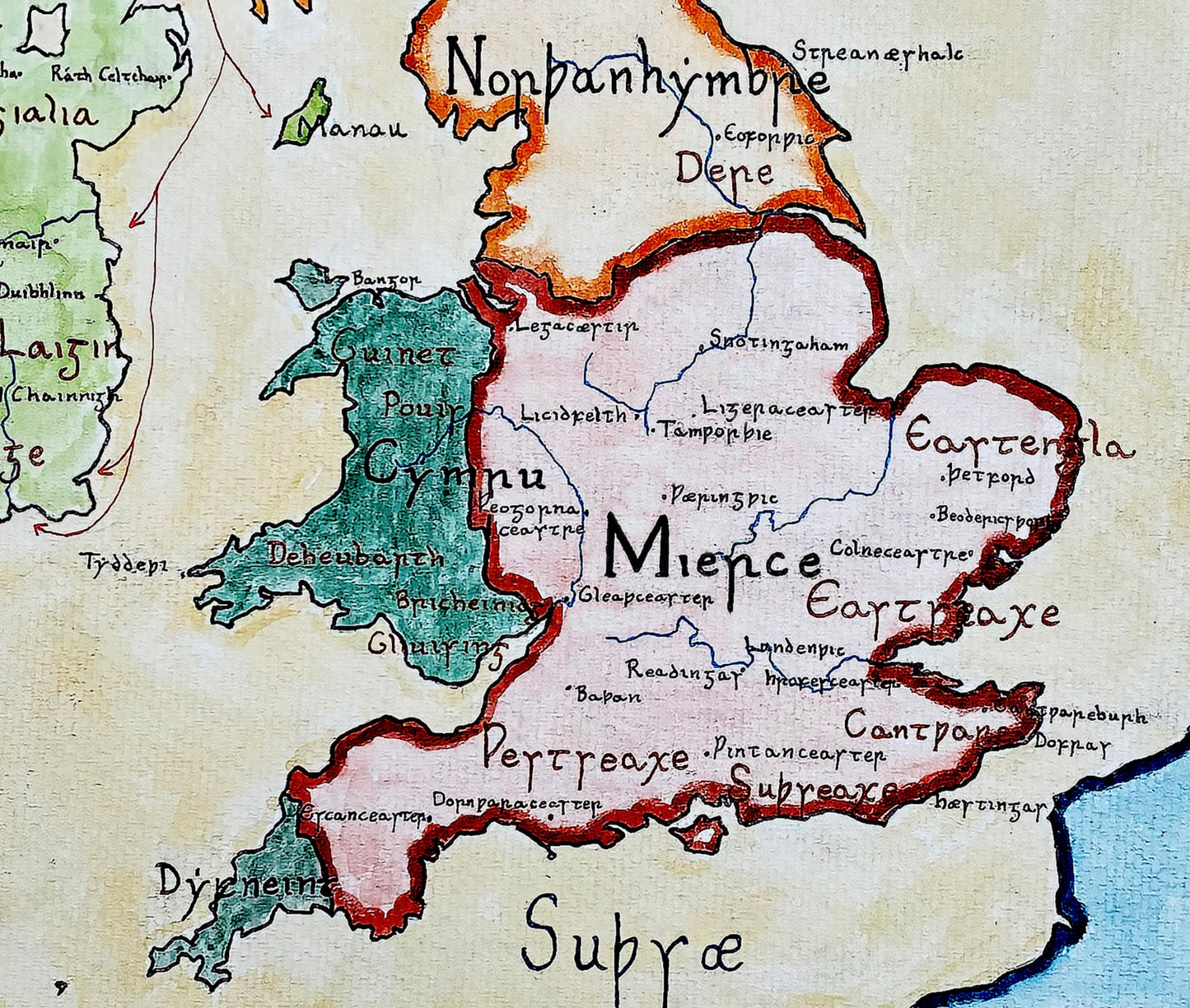
Anglo-Saxon England Map, c. 8th Century — The Heptarchy under Mercian Supremacy
Anglo-Saxon England Map, c. 8th Century — The Heptarchy under Mercian Supremacy
Couldn't load pickup availability
Hand-painted and historically researched map of Anglo-Saxon Britain during the era of Mercian supremacy in the eighth century. This period marked the political ascendancy of the Kingdom of Mercia, which exercised overlordship across much of southern England while Northumbria retained its independence in the north.
Rather than presenting the so-called “Heptarchy” as a fixed or neatly defined system of seven equal kingdoms, this map reflects the political realities of early medieval Britain: shifting hierarchies, regional dominance, and fluid frontiers. The principal Anglo-Saxon polities—Mercia, Wessex, Northumbria, East Anglia, Kent, Sussex, and Essex—are depicted within the context of Mercian hegemony, emphasizing overlordship rather than modern concepts of centralized sovereignty.
This revised edition corrects earlier anachronisms and aligns more closely with contemporary evidence. Later heraldic coats of arms—unknown to the early medieval period—have been removed and replaced with symbols attested in early sources, including the raven banner associated with Scandinavian forces and traditional emblems linked to Wessex.
The map also incorporates Insular Minuscule script, the distinctive writing system used in Britain and Ireland during this period and famously preserved in manuscripts such as the Book of Kells and the Lindisfarne Gospels. This stylistic choice reinforces the intellectual and monastic culture that shaped early medieval Britain, replacing later Gothic scripts that would not have been in use at the time.
Borders and territorial divisions are based on current historical scholarship and reflect the political landscape as it would have appeared in the eighth century, rather than projecting later medieval England backward onto an earlier era. The result is a historically grounded visualization of Anglo-Saxon political geography before the unification of England.
High-quality giclée print available in multiple sizes. The printed version preserves greater clarity and detail than compressed online images.
This map was researched and hand-painted by a trained historical cartographer with academic experience in European and global history. Each CartographyCraft map is designed to prioritize historical accuracy, visual clarity, and period-appropriate aesthetics over modern anachronism. If you are interested in a print with a frame or the original, contact the site owner directly.


-
Shipping
Maps are shipped sealed in a tube via UPS, USPS, and FedEx. Please allow up to 2 weeks for your map to arrive.
-
Return Policy
Not happy with the product? Full refund on returns up to 30 days after purchase.