


CartographyCraft
Ashikaga Shogunate Map – Daimyō Japan during the Muromachi Period (16th Century)
Ashikaga Shogunate Map – Daimyō Japan during the Muromachi Period (16th Century)
Couldn't load pickup availability
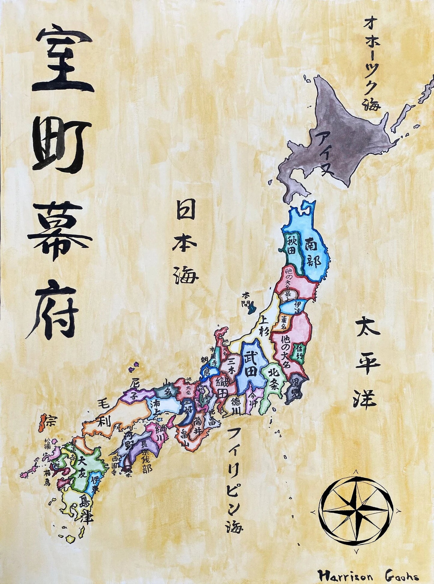
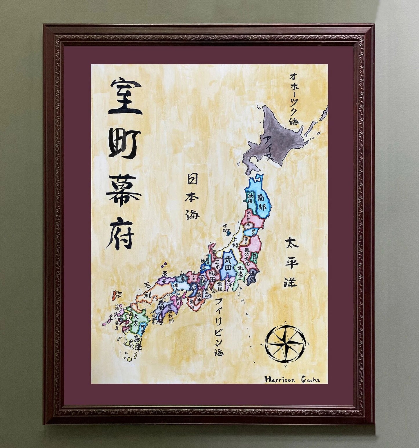
Hand-painted and researched map of Japan during the late Muromachi period under the Ashikaga shogunate, depicting the territorial domains of major daimyō prior to the political consolidation initiated by Oda Nobunaga in the late sixteenth century.
This was an era defined less by centralized authority than by regional military power. Although the Ashikaga shoguns formally ruled from Kyoto, effective control over much of the archipelago rested with competing daimyō houses whose alliances and rivalries shaped the political geography of Japan. The map presents these domains as contemporaries would have understood them: as territorial spheres of influence rather than modern prefectural units.
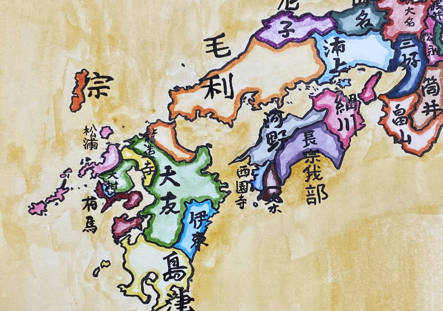
All provincial and domain names are rendered in Japanese calligraphy, emphasizing linguistic and cultural context rather than retrofitted English exonyms. The use of kanji situates the viewer within the period’s intellectual world, while regional color differentiation clarifies the fragmentation of authority characteristic of the era.
Geographically, the work includes the full Japanese archipelago — from Hokkaidō in the north to Kyūshū in the south — with major surrounding bodies of water labeled to anchor the political divisions within their maritime setting. The visual hierarchy prioritizes domain boundaries, reflecting the decentralized military order that defined the late Ashikaga system.
Stylistically, the composition draws upon archival aesthetics while remaining legible to a modern audience. Borders and tonal contrasts are structured to convey political fragmentation without imposing later Tokugawa-era unity or modern prefectural divisions. No anachronistic boundaries are introduced.
The result is a historically grounded cartographic interpretation of Japan on the eve of unification — a landscape of competing warlords, shifting alliances, and emergent state formation.
Rendered in ink and watercolor on a parchment-toned ground.
High-quality giclée print available in multiple sizes. The printed version preserves finer calligraphic detail and sharper boundary definition than compressed online images.
This map was researched and hand-painted by a historical cartographer with academic training in global history. Each CartographyCraft work prioritizes historical accuracy, period-appropriate representation, and conceptual coherence over simplified decorative design. Framed prints or inquiries regarding the original artwork may be directed to the site owner.

-
Shipping
Maps are shipped sealed in a tube via UPS, USPS, and FedEx. Please allow up to 2 weeks for your map to arrive.
-
Return Policy
Not happy with the product? Full refund on returns up to 30 days after purchase.