


CartographyCraft
Portuguese Empire, c. 1580 – A Cartographic Reconstruction of Global Lusitanian Expansion
Portuguese Empire, c. 1580 – A Cartographic Reconstruction of Global Lusitanian Expansion
Couldn't load pickup availability
Hand-painted and researched map of the Portuguese Empire at the close of the sixteenth century, centered on the year 1580 — a pivotal moment marking the dynastic union of the Portuguese and Spanish crowns under Philip II, yet still reflecting the distinct global network constructed by Portugal during the Age of Discoveries.
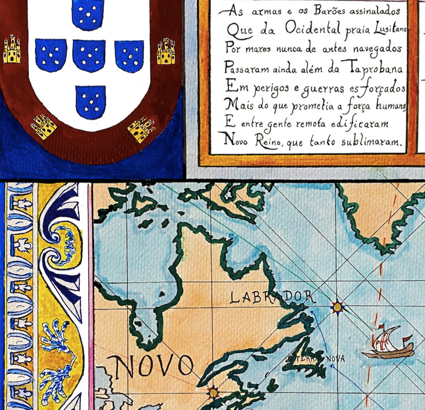
The composition reconstructs the maritime imperial system linking Lisbon to Brazil, West Africa, the Cape route, the Estado da Índia, and trading posts extending to Southeast Asia and the South China Sea. Rather than presenting a modern political map retroactively colored, this work adopts the structural logic of sixteenth-century nautical cartography. The rhumbline network and windrose framework evoke the navigational practices used by Iberian pilots during the height of oceanic expansion.
Territorial demarcations reflect the geopolitical order shaped by the Treaty of Tordesillas (1494) and the Treaty of Zaragoza (1529), which divided the non-European world between Portugal and Spain along longitudinal meridians. These agreements structured early modern imperial geography and formalized competing claims across the Atlantic and Indian Oceans.
Selections from Os Lusíadas by Luís de Camões are incorporated into the design, situating the empire not only as a commercial and navigational enterprise but also as a literary and cultural project. The poem, composed in the aftermath of Portugal’s maritime ascendancy, frames expansion as both heroic and providential — an ideological dimension that informed imperial self-understanding.
Stylistically and conceptually, the map follows early modern Iberian cartographic conventions while remaining legible to a contemporary viewer. The rhumbline grid, tonal palette, and proportional structure are designed to evoke period charts without directly reproducing any single archival document. No later colonial borders or nineteenth-century imperial expansions are imposed upon the sixteenth-century framework.
The result is a historically grounded visual interpretation of Portugal’s global maritime empire at its structural height — a network defined less by contiguous territory than by fortified ports, trade corridors, and navigational mastery.
Rendered in ink and watercolor on an aged parchment-toned ground.
High-quality giclée print available in multiple sizes. The printed version preserves finer linework and greater clarity than compressed online images.
This map was researched and hand-painted by a historical cartographer with academic training in European and global history. Each CartographyCraft work prioritizes historical accuracy, conceptual rigor, and period-appropriate aesthetics over simplified decorative representation. Framed prints or inquiries regarding the original artwork may be directed to the site owner.


-
Shipping
Maps are shipped sealed in a tube via UPS, USPS, and FedEx. Please allow up to 2 weeks for your map to arrive.
-
Return Policy
Not happy with the product? Full refund on returns up to 30 days after purchase.