


CartographyCraft
The Atlantic World, 1650: Imperial Claims and Colonial Expansion in North America
The Atlantic World, 1650: Imperial Claims and Colonial Expansion in North America
Couldn't load pickup availability
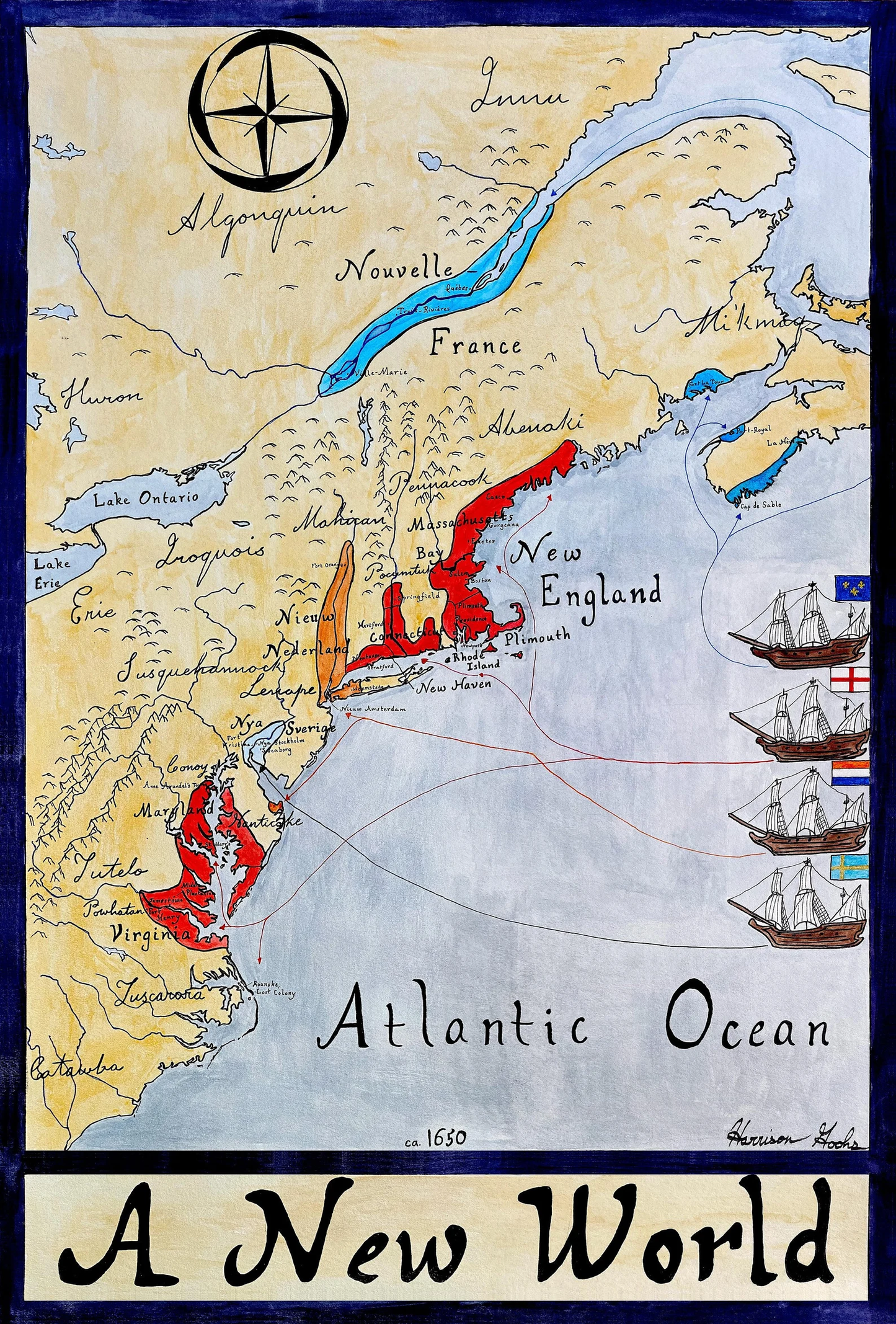
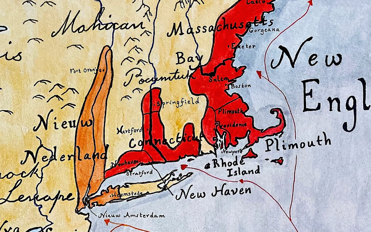
This map reconstructs the geopolitical landscape of North America in the mid-seventeenth century—a moment when imperial ambition far exceeded demographic reality.
By 1650, English settlements in New England and Virginia remained fragile coastal enclaves, while Maryland consolidated its foothold to the south. French influence expanded aggressively along the St. Lawrence River and into the Great Lakes basin, creating the foundations of New France. In the Mid-Atlantic, the Dutch colony of New Netherland, centered on Nieuw Amsterdam, contended with the short-lived Swedish presence along the Delaware River.
This map seeks to represent competing imperial claims, spheres of trade, and frontier zones as they would have been understood by contemporaries.
Each territorial boundary and settlement marker has been reconstructed through consultation of period maps, colonial charters, and modern historical scholarship. Rather than reproducing a single historical source, this piece synthesizes multiple seventeenth-century perspectives to create a coherent and historically grounded visual interpretation.
Typography and labeling reflect contemporary usage while maintaining clarity for modern viewers.
This map was researched and hand-painted by a trained historical cartographer with academic experience in European and global history. Each CartographyCraft map is designed to prioritize historical accuracy, visual clarity, and period-appropriate aesthetics over modern anachronism. If you are interested in a print with a frame or the original, contact the site owner directly.

-
Shipping
Maps are shipped sealed in a tube via UPS, USPS, and FedEx. Please allow up to 2 weeks for your map to arrive.
-
Return Policy
Not happy with the product? Full refund on returns up to 30 days after purchase.