

CartographyCraft
The Danelaw, c. 878–900: Runic Map of Viking and Anglo-Saxon Britain
The Danelaw, c. 878–900: Runic Map of Viking and Anglo-Saxon Britain
Couldn't load pickup availability
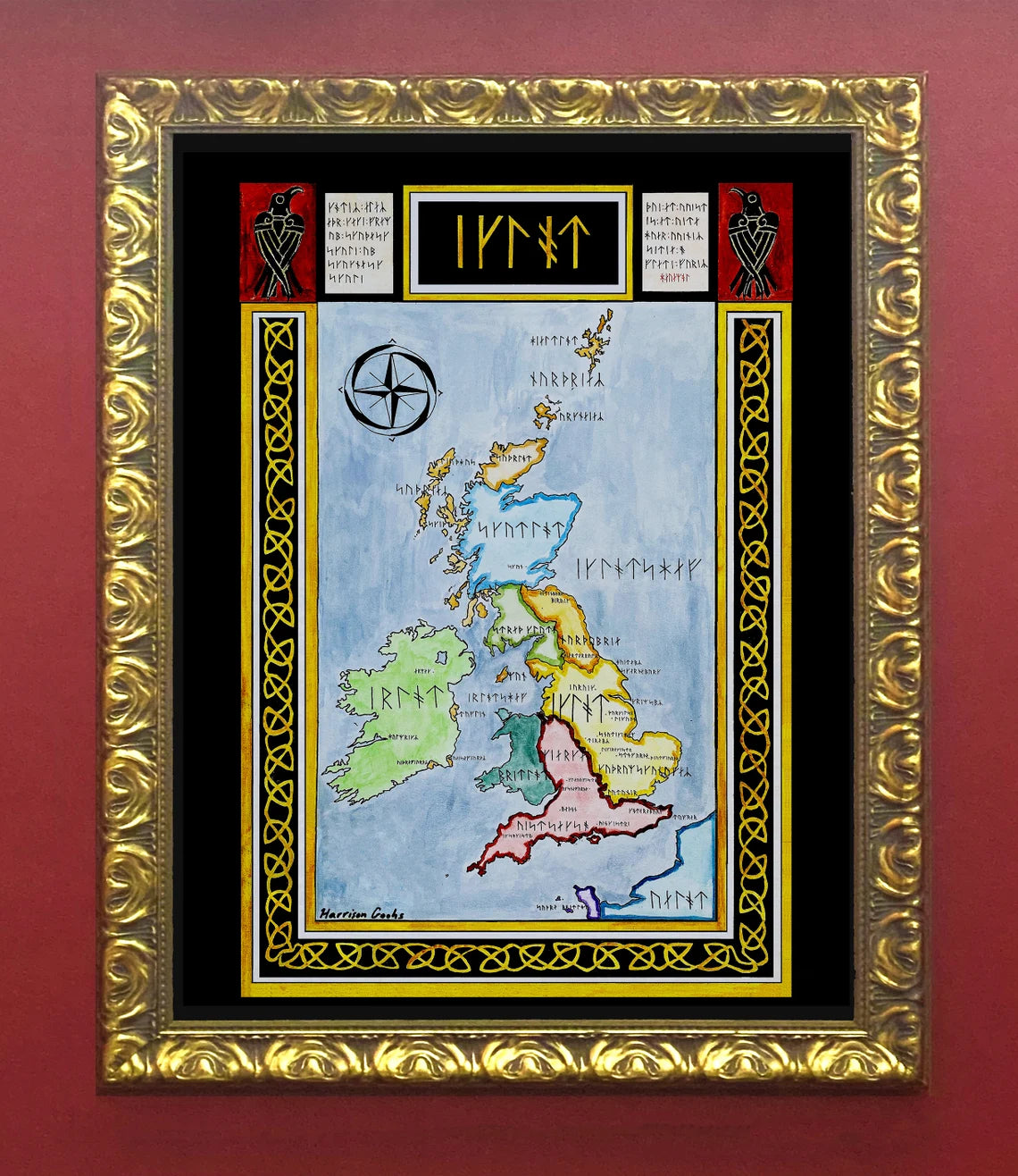
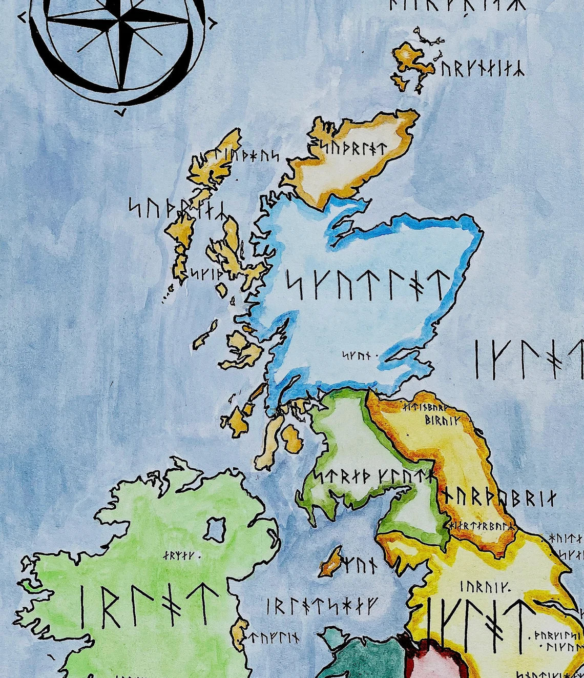
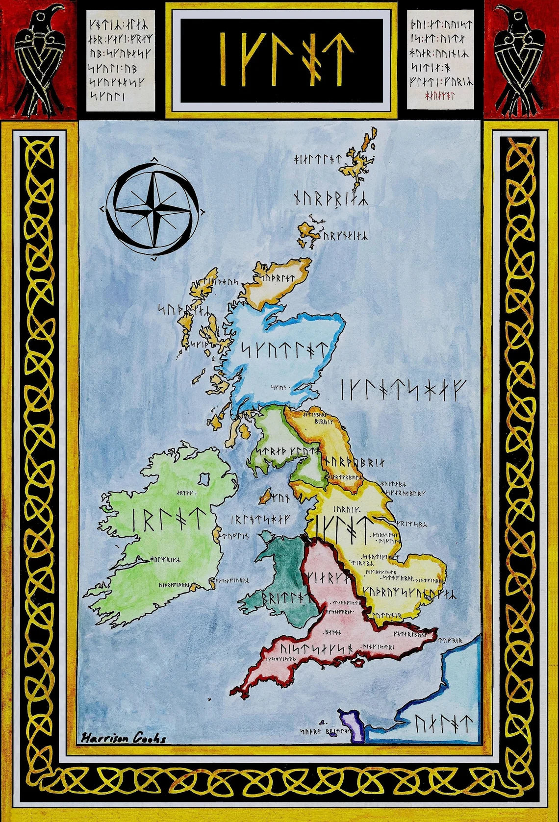
Handpainted and researched map of Britain in the late ninth century, after the campaigns of the Great Heathen Army and the establishment of Scandinavian political authority across large portions of eastern and northern England. Centered on the period following the Treaty of Alfred and Guthrum (c. 878), the map depicts the territorial division between Anglo-Saxon kingdoms and the region later known as the Danelaw.
Rather than presenting a retrospective or unified “England,” the map emphasizes the fractured political landscape of the period: Wessex consolidating power in the south; Mercia reduced and divided; Northumbria under Scandinavian rule; and Norse influence extending across the Irish Sea through Dublin and the Kingdom of the Isles. The objective is to reflect the unstable and negotiated character of authority in late ninth-century Britain rather than impose later medieval or modern boundaries.
All geographic names are rendered in Long-branch Younger Futhark and transliterated according to reconstructed Old Norse phonology where possible, or Old English where Scandinavian equivalents are unattested. The use of runic script is not decorative but philological: it is intended to approximate how Scandinavian elites operating within the Danelaw might have conceptualized and recorded the landscape. This linguistic framing underscores the cultural transformation accompanying military conquest and settlement.
Stylistically, the map draws upon early medieval cartographic sensibilities while remaining legible to a modern viewer. Borders, labels, and color hierarchy are structured to clarify political control and spheres of influence rather than later national identities. No anachronistic kingdoms or unified English state are imposed upon the ninth-century setting.
High-quality giclée print available in multiple sizes. The printed version preserves greater clarity and detail than compressed online images.
This map was researched and hand-painted by a trained historical cartographer with academic experience in European and global history. Each CartographyCraft map prioritizes historical accuracy, linguistic precision, and period-appropriate aesthetics over modern projection. If you are interested in a framed print or the original, please contact the site owner directly.


-
Shipping
Maps are shipped sealed in a tube via UPS, USPS, and FedEx. Please allow up to 2 weeks for your map to arrive.
-
Return Policy
Not happy with the product? Full refund on returns up to 30 days after purchase.