


CartographyCraft
Gallic Wars Map – Julius Caesar and the Roman Conquest of Gaul
Gallic Wars Map – Julius Caesar and the Roman Conquest of Gaul
Couldn't load pickup availability
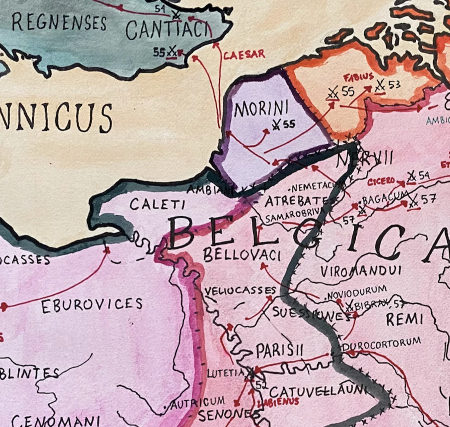
Hand-painted and researched map of the Gallic Wars (58–50 BCE), depicting Julius Caesar’s campaigns across Gaul and the transformation of the region into a Roman province.
The composition traces major campaigns, tribal territories, and decisive engagements, including the revolt led by Vercingetorix and the climactic siege of Alesia. Rather than presenting Gaul as a unified entity, the map emphasizes its mosaic of Celtic polities—Aedui, Arverni, Helvetii, and others—whose rivalries shaped the course of Roman intervention.
Caesar’s conquest not only secured immense military prestige but also permanently integrated Gaul into the Roman political and cultural sphere. The map reflects this transitional moment: a frontier region at the edge of the Roman Republic, soon to become a cornerstone of the Latin West.
Topography, river systems, and tribal boundaries are rendered to clarify both strategic movement and regional diversity, grounding the narrative of conquest in geographic reality.
High-quality giclée print available in multiple sizes. The printed version preserves greater clarity and detail than compressed online images.
This map was researched and hand-painted by a trained historical cartographer with academic experience in European and global history. Each CartographyCraft map is designed to prioritize historical accuracy, visual clarity, and period-appropriate aesthetics over modern anachronism. If you are interested in a print with a frame or the original, contact the site owner directly.


-
Shipping
Maps are shipped sealed in a tube via UPS, USPS, and FedEx. Please allow up to 2 weeks for your map to arrive.
-
Return Policy
Not happy with the product? Full refund on returns up to 30 days after purchase.