


CartographyCraft
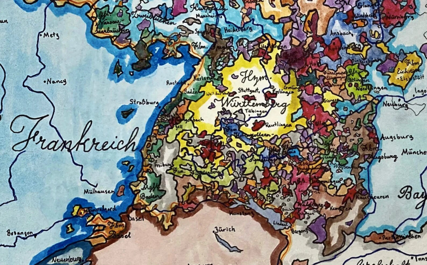
Holy Roman Empire, 1789 — Central Europe on the Eve of Revolution
Holy Roman Empire, 1789 — Central Europe on the Eve of Revolution
Couldn't load pickup availability
Hand-painted and historically researched map of the Holy Roman Empire in 1789, depicting Central Europe on the eve of the French Revolution and just prior to the collapse of the old imperial order.
The map illustrates the extraordinary political fragmentation of the Empire, composed of hundreds of secular and ecclesiastical estates, free cities, and principalities. While exact counts of sovereign entities vary even among contemporaries, this work represents the imperial structure as accurately as surviving sources allow, reflecting the Empire’s famously complex constitutional reality.
Surrounding powers loom large. Austria and Prussia dominate imperial politics from within, while France stands poised at the western frontier. To the east, the Polish–Lithuanian Commonwealth endures in a weakened state, only a few years before its final partition erased it from the map of Europe.
Within a decade, the French Revolutionary and Napoleonic Wars would dismantle this intricate political mosaic. The Holy Roman Empire would be dissolved in 1806, and Central Europe fundamentally reorganized along modern territorial lines. This map captures the Empire at its final moment of institutional continuity—complex, anachronistic, and on the brink of extinction. Interested in more? Click here
This work is available as a high-quality giclée print in multiple sizes. Fine details may appear softened in online images due to compression; the printed version is significantly clearer.
This map was researched and hand-painted by a trained historical cartographer with academic experience in European and global history. Each CartographyCraft map is designed to prioritize historical accuracy, visual clarity, and period-appropriate aesthetics over modern anachronism. If you are interested in a print with a frame or the original, contact the site owner directly.


-
Shipping
Maps are shipped sealed in a tube via UPS, USPS, and FedEx. Please allow up to 2 weeks for your map to arrive.
-
Return Policy
Not happy with the product? Full refund on returns up to 30 days after purchase.