


CartographyCraft
Viking Age Map in Runes – Norse Expansion in Younger Futhark
Viking Age Map in Runes – Norse Expansion in Younger Futhark
Couldn't load pickup availability
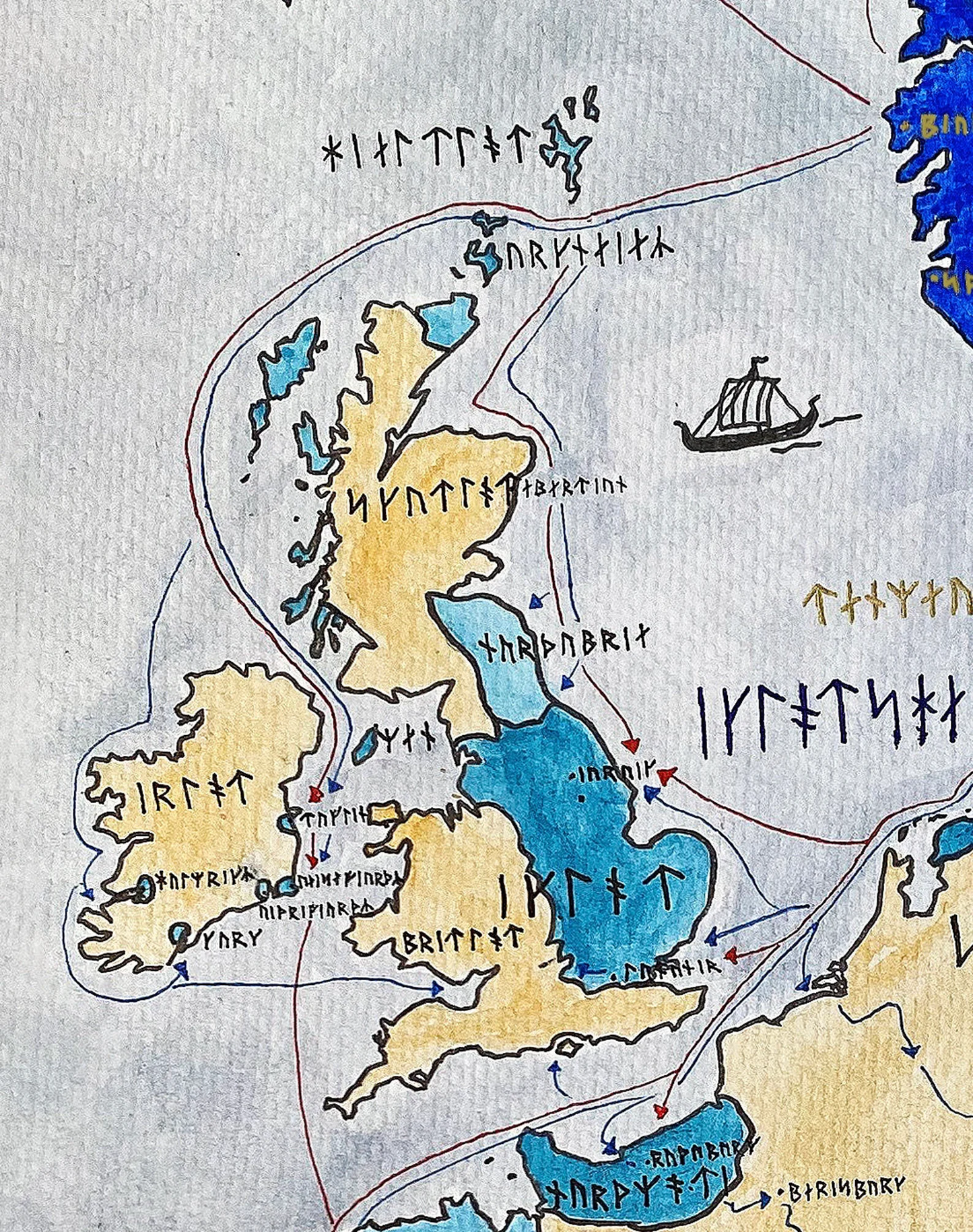
Hand-painted and researched map of the Viking Age (c. 793–1066), rendered entirely in Long-branch Younger Futhark runes. All place names are transliterated to approximate Old Norse phonology rather than modern Scandinavian spellings, preserving linguistic consistency with the historical period.
Where possible, extant runic inscriptions from Scandinavia were consulted to verify orthographic conventions and rune forms. The script reflects the long-branch variant associated primarily with Danish and broader Scandinavian usage during the height of Viking maritime activity.
The map traces Norse expansion across the North Atlantic and into continental Europe: from the British Isles and Normandy to the river systems of Eastern Europe, from Iceland and Greenland to Vinland in North America. Trade routes, settlement zones, and spheres of raiding activity are presented within their geographic context, emphasizing that the Viking Age was as much a period of commerce, colonization, and state formation as it was of warfare.
Scandinavian homelands are centered as the cultural core, while regions such as the Danelaw, the Kievan river routes, the North Atlantic colonies, and Mediterranean ventures illustrate the extraordinary geographic reach of Norse networks. The composition avoids later national borders and instead reflects early medieval political and maritime realities.
Designed for scholars of medieval Scandinavia, enthusiasts of Norse history, linguists interested in runology, and collectors of historical cartography, this work aims to balance philological accuracy with visual clarity. The runic system is not decorative imitation but a historically grounded orthographic reconstruction.
High-quality giclée print available in multiple sizes. The printed version preserves greater clarity and detail than compressed online images.
This map was researched and hand-painted by a trained historical cartographer with academic experience in European and global history. Each CartographyCraft map is designed to prioritize historical accuracy, visual clarity, and period-appropriate aesthetics over modern anachronism. If you are interested in a print with a frame or the original, contact the site owner directly.


-
Shipping
Maps are shipped sealed in a tube via UPS, USPS, and FedEx. Please allow up to 2 weeks for your map to arrive.
-
Return Policy
Not happy with the product? Full refund on returns up to 30 days after purchase.