


CartographyCraft
Cold War Map; Space Race
Cold War Map; Space Race
Couldn't load pickup availability
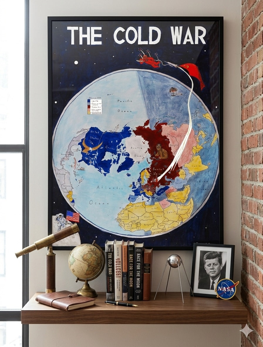
Handpainted and researched map of Cold War geopolitical alliances, capturing the peak of the bipolar world order. Centered on the year 1959, the map depicts the rigid territorial and ideological divisions between the Western Bloc and the Eastern Bloc at a pivotal moment in the mid-20th century.
The map utilize a North Pole-centered azimuthal perspective, emphasizing the strategic proximity of the superpowers across the Arctic. The visual narrative focuses on the global standoff: the American eagle and the Soviet bear looming over their respective spheres of influence, illustrating a world partitioned by the Iron Curtain and collective defense treaties like NATO and the Warsaw Pact. The objective is to reflect the existential tension of the era, where traditional borders were superseded by ideological frontiers and the looming threat of nuclear brinkmanship.
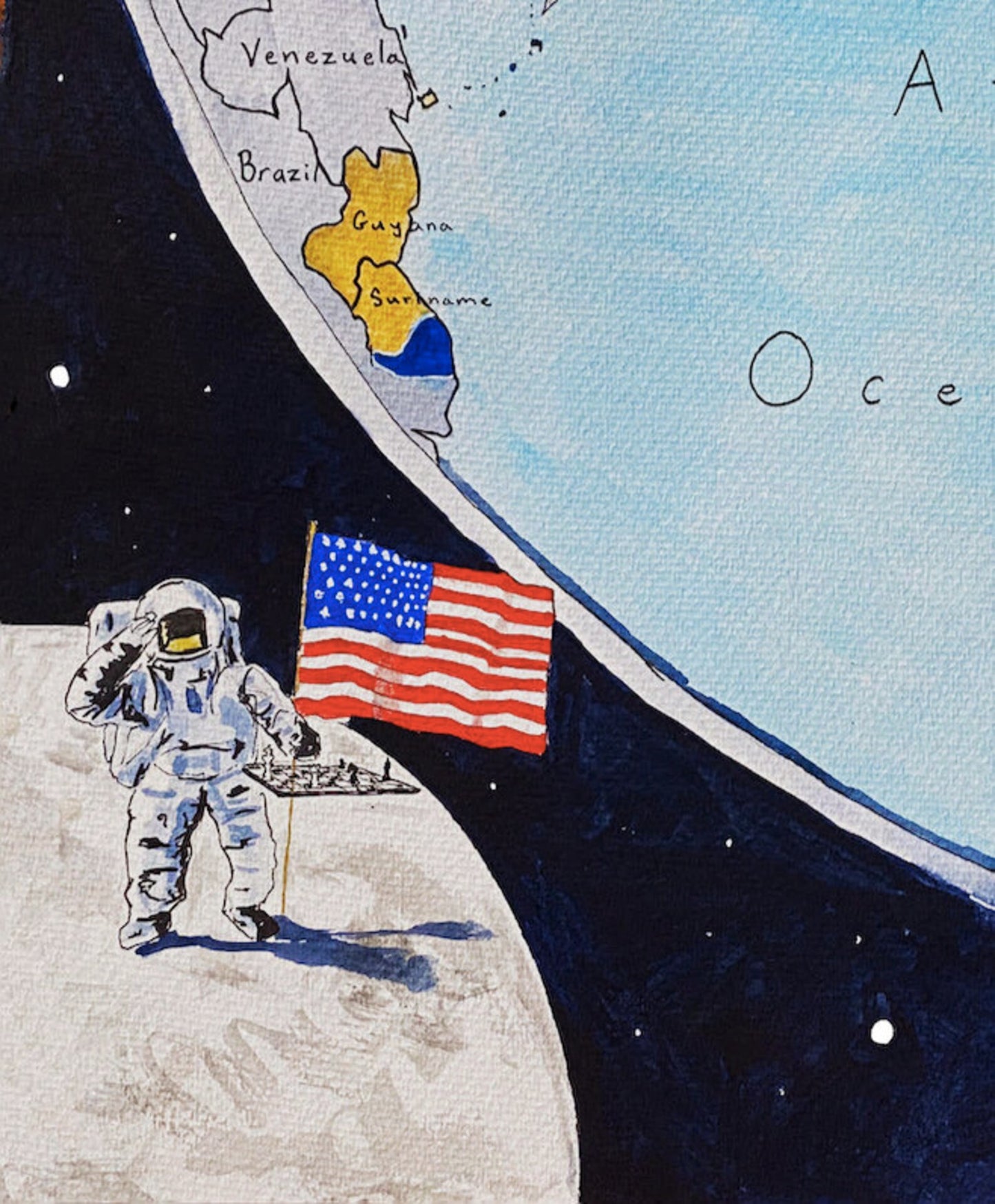
The map prominently features the Space Race, a primary theater of Cold War competition. From the Soviet cosmonaut tethered to a soaring rocket to the American astronaut planting the flag on the lunar surface, these figures represent the extension of terrestrial rivalry into the cosmos. This framing underscores how the "Final Frontier" became a crucial tool for propaganda and a demonstration of technological superiority.
Stylistically, the work blends mid-century illustrative aesthetics with modern cartographic clarity. Borders, color hierarchies, and symbolic iconography—such as the mushroom cloud and satellite paths—are structured to clarify the "zero-sum" nature of the conflict. No modern post-Soviet boundaries are imposed; instead, the map remains faithful to the 1959 setting, preserving the fragile and dangerous balance of a world divided in two.
High-quality giclée print available in multiple sizes. The printed version preserves greater clarity and detail than compressed online images.
This map was researched and hand-painted by a trained historical cartographer with academic experience in European and global history. Each CartographyCraft map prioritizes historical accuracy, linguistic precision, and period-appropriate aesthetics over modern projection. If you are interested in a framed print or the original, please contact the site owner directly.


-
Shipping
Maps are shipped sealed in a tube via UPS, USPS, and FedEx. Please allow up to 2 weeks for your map to arrive.
-
Return Policy
Not happy with the product? Full refund on returns up to 30 days after purchase.