


CartographyCraft
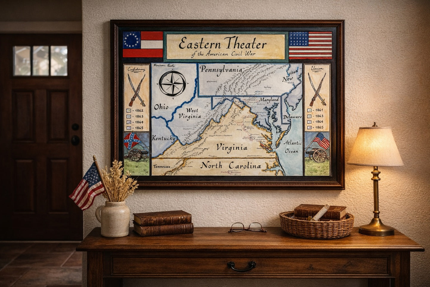
Eastern Theater of the American Civil War (1861–1865) — Campaign and Battle Map
Eastern Theater of the American Civil War (1861–1865) — Campaign and Battle Map
Couldn't load pickup availability
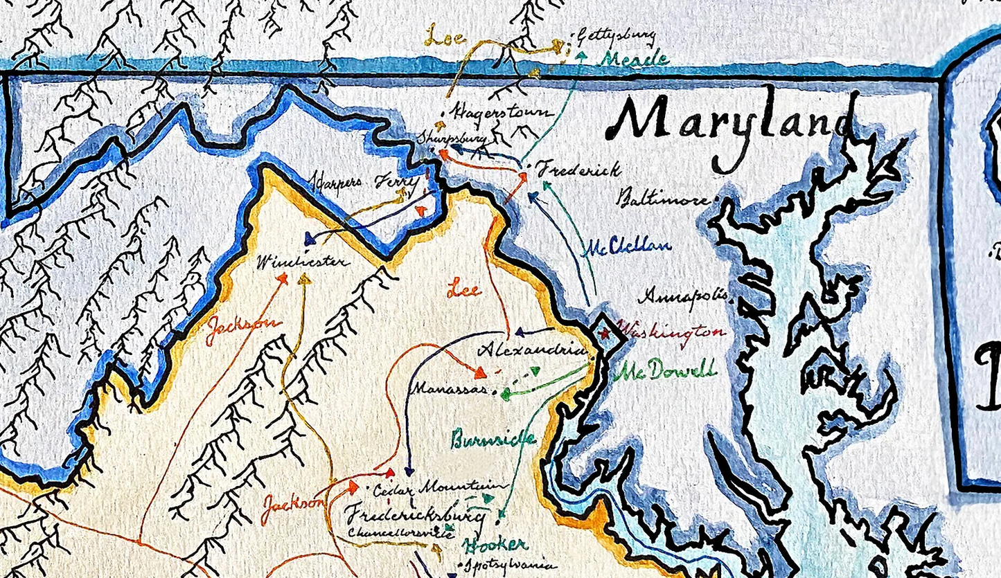
Hand-painted and historically researched map of the Eastern Theater of the American Civil War, covering the principal campaigns and engagements from 1861 to 1865. This theater encompassed the strategic corridor between Washington, D.C., and Richmond and witnessed many of the war’s most consequential battles.
Rather than presenting a decorative overview, the map emphasizes the operational geography of the conflict: river systems, mountain barriers, and state boundaries that shaped military movement and strategic decision-making. The contested landscape of Virginia, Maryland, and Pennsylvania is central, reflecting the sustained campaigns that defined the eastern war.
Major engagements are marked, including the Battle of Gettysburg, the Battle of Antietam (Sharpsburg), the First Battle of Bull Run (Manassas), the Battle of Chancellorsville, the Battle of Fredericksburg, Cold Harbor, and Mechanicsville. These engagements illustrate the shifting strategic initiatives between Union and Confederate forces across successive campaigning seasons.
The map situates these battles within the broader leadership and strategic context of figures such as Abraham Lincoln, Robert E. Lee, Ulysses S. Grant, Thomas J. Jackson, and William Tecumseh Sherman, while keeping the emphasis on terrain and campaign movement rather than biographical narrative.
Stylistically, the composition draws on nineteenth-century American cartographic aesthetics while remaining legible to a modern viewer. State borders, year-by-year campaign indicators, and symbolic elements distinguish phases of the conflict without imposing retrospective simplifications.
The result is a clear visual interpretation of the Eastern Theater as a dynamic operational space—one defined as much by geography and logistics as by battlefield outcomes.
High-quality giclée print available in multiple sizes. The printed version preserves greater clarity and detail than compressed online images.
This map was researched and hand-painted by a trained historical cartographer with academic experience in European and global history. Each CartographyCraft map is designed to prioritize historical accuracy, visual clarity, and period-appropriate aesthetics over modern anachronism. If you are interested in a print with a frame or the original, contact the site owner directly.


-
Shipping
Maps are shipped sealed in a tube via UPS, USPS, and FedEx. Please allow up to 2 weeks for your map to arrive.
-
Return Policy
Not happy with the product? Full refund on returns up to 30 days after purchase.