


CartographyCraft
Ancient Egypt Map – Nile Civilization in Hieroglyphs
Ancient Egypt Map – Nile Civilization in Hieroglyphs
Couldn't load pickup availability
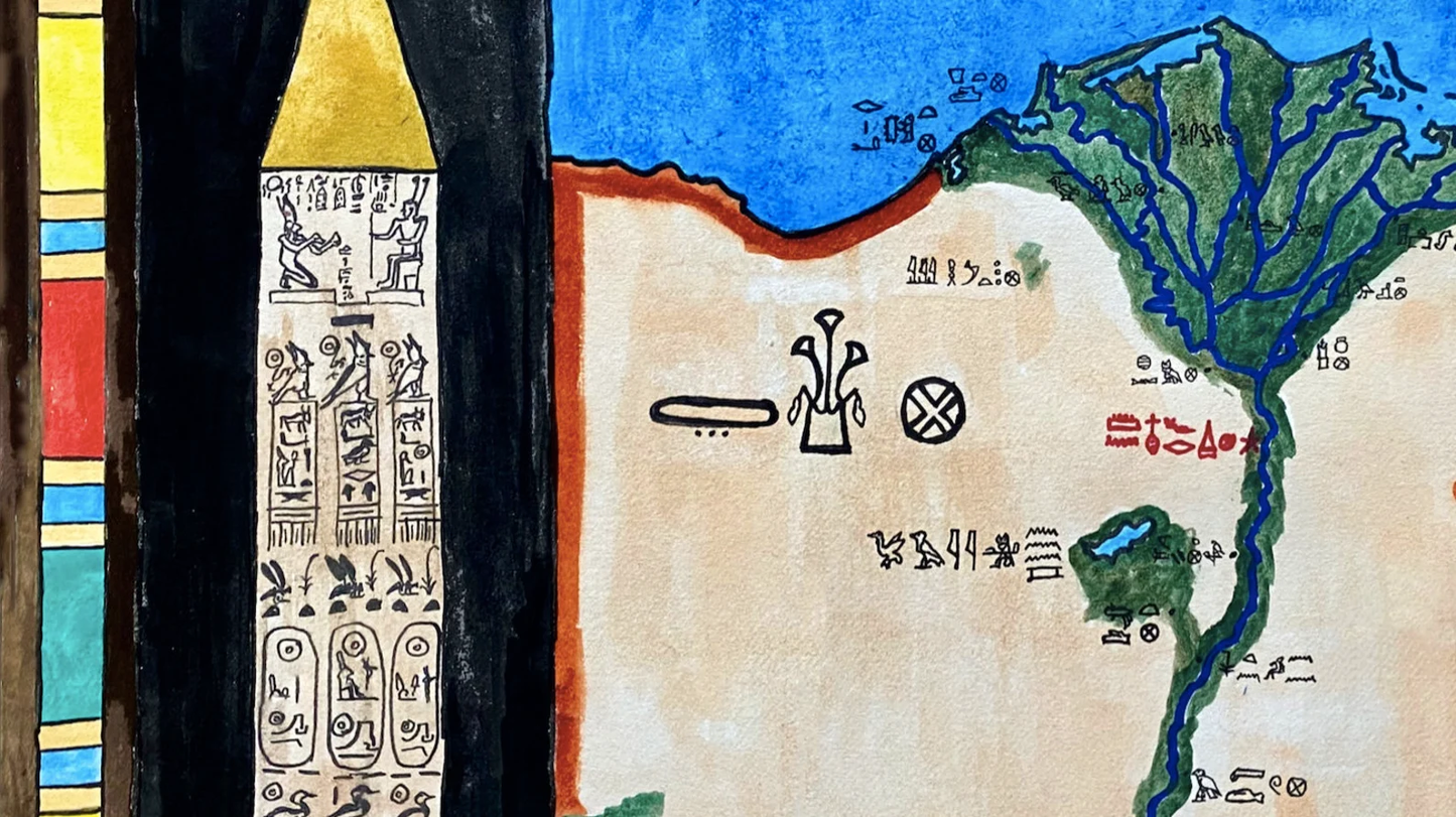
Hand-painted and researched map of Ancient Egypt, with inscriptions rendered in Egyptian hieroglyphs to reflect pharaonic-era linguistic tradition.
The map centers on the Nile River as the organizing axis of Egyptian civilization, from Upper Egypt in the south to Lower Egypt in the Delta. Major cities, sacred sites, and regional divisions are positioned in relation to the river’s annual inundation cycle, which underpinned agriculture, political authority, and religious cosmology.
The Nile valley is framed by stylized obelisk forms inspired by monuments from Luxor, reinforcing the architectural and symbolic vocabulary of ancient Egyptian statecraft. Rather than imposing modern national boundaries, the composition reflects Egypt as a riverine civilization defined by floodplain geography and dynastic continuity.
Hieroglyphic elements are incorporated with attention to historical form, emphasizing the integration of language, monumentality, and territorial identity in ancient Egyptian culture.
High-quality giclée print available in multiple sizes. The printed version preserves greater clarity and detail than compressed online images.
This map was researched and hand-painted by a trained historical cartographer with academic experience in European and global history. Each CartographyCraft map is designed to prioritize historical accuracy, visual clarity, and period-appropriate aesthetics over modern anachronism. If you are interested in a print with a frame or the original, contact the site owner directly.


-
Shipping
Maps are shipped sealed in a tube via UPS, USPS, and FedEx. Please allow up to 2 weeks for your map to arrive.
-
Return Policy
Not happy with the product? Full refund on returns up to 30 days after purchase.