


CartographyCraft
Europe After the First World War (1923) — An Endonym Map of the Interwar Order
Europe After the First World War (1923) — An Endonym Map of the Interwar Order
Couldn't load pickup availability
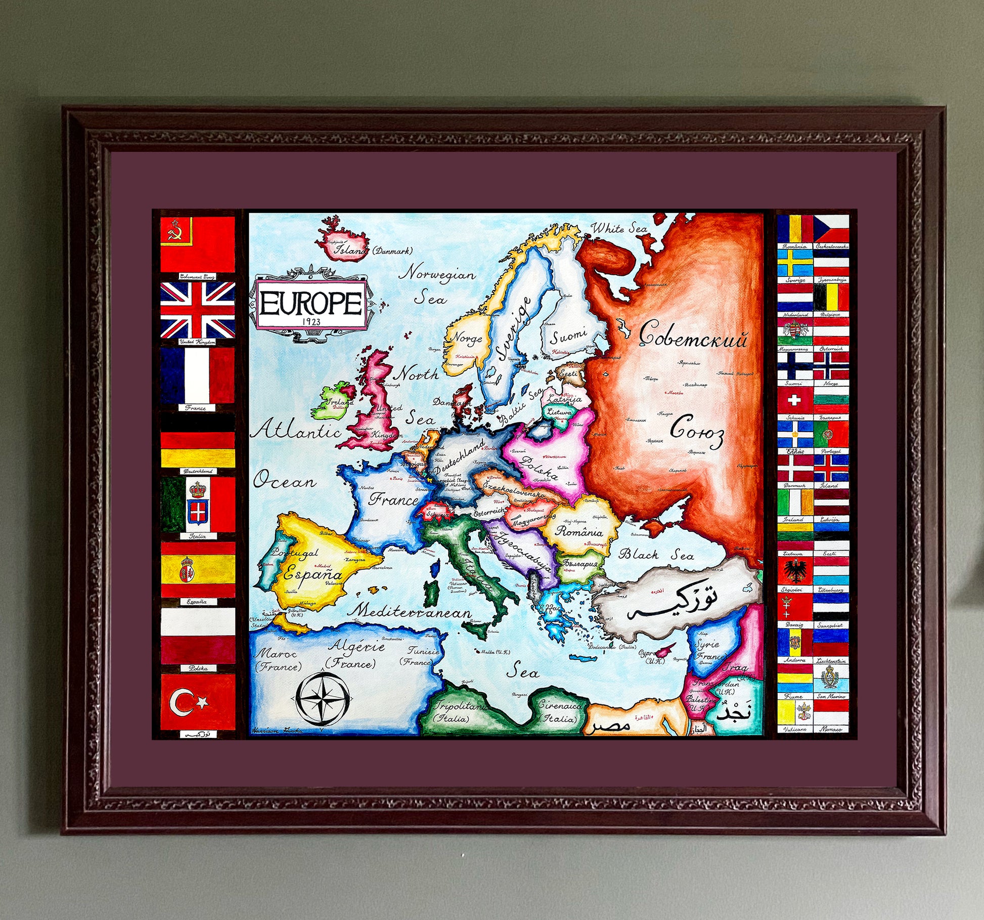
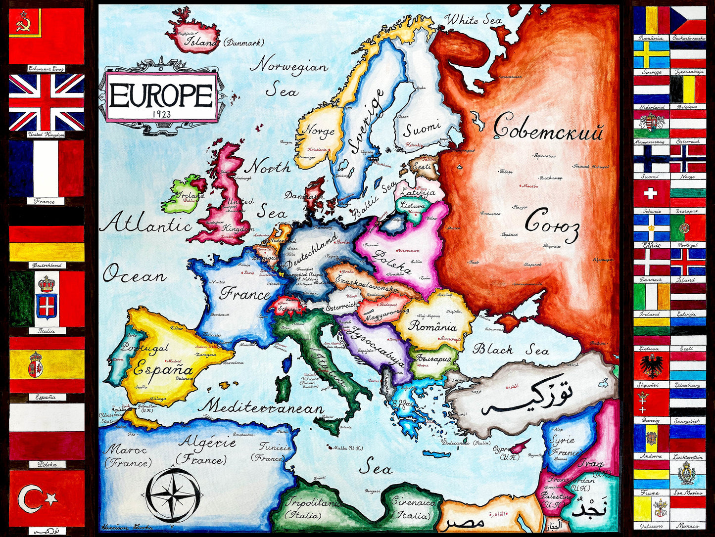
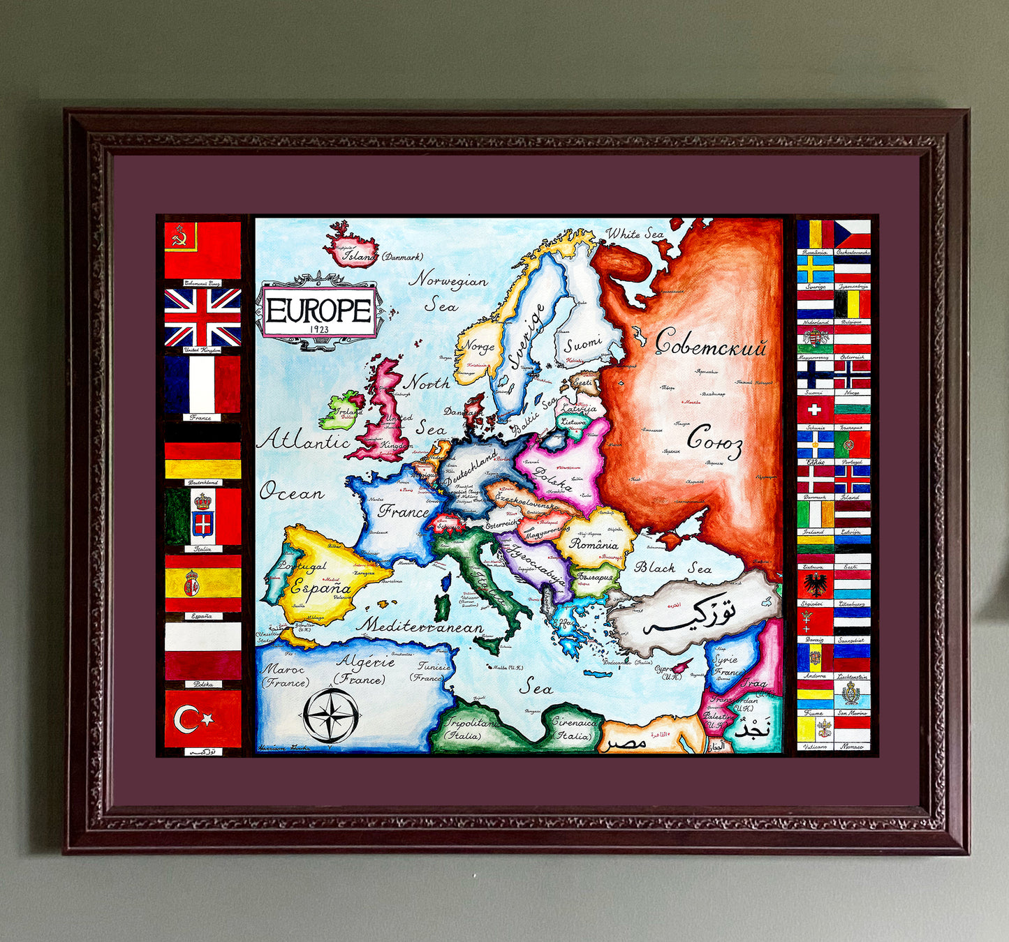
Hand-painted and historically researched map of Europe in 1923, depicting the fragile political order that emerged in the aftermath of the First World War. This moment captures a continent reshaped by the collapse of empires and the creation of new nation-states under the postwar settlement.
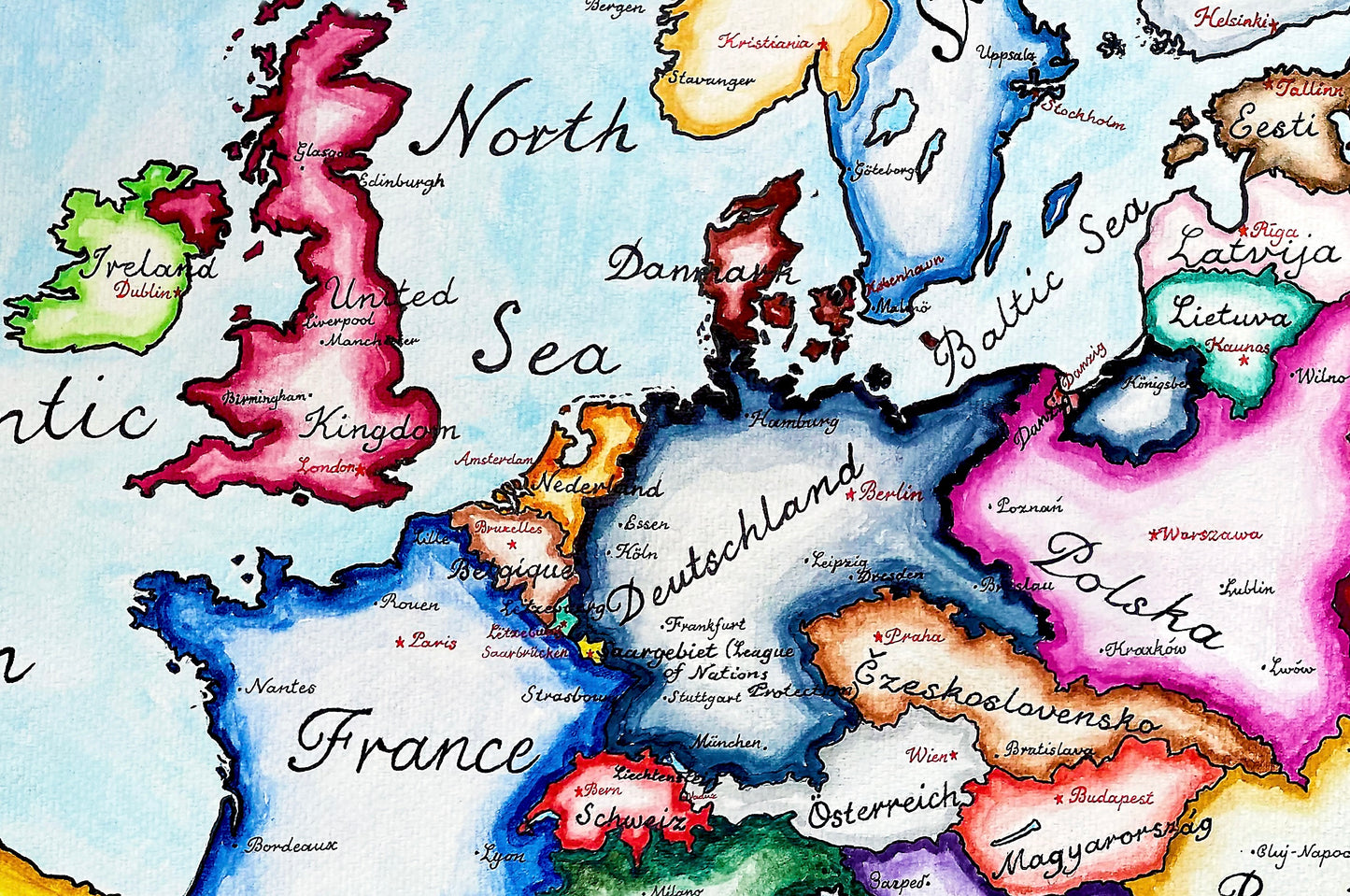
Each country and major city is labeled using endonyms rather than exonyms, rendered in the local language and script. The map therefore reflects how Europeans identified themselves at the time, rather than later Anglicized or standardized naming conventions. Newly formed states such as Czechoslovakia and Yugoslavia appear alongside the remnants of older imperial structures, while the Soviet Union emerges as a distinct political entity.
National flags are included to emphasize sovereignty and the reordering of political authority across the continent. Together, these elements present Europe at a moment of uncertainty—between the devastation of the Great War and the conflicts that would soon follow.
This map is available as a high-quality giclée print in multiple sizes. Fine details may appear softened in online images due to compression.
This map was researched and hand-painted by a trained historical cartographer with academic experience in European and global history. Each CartographyCraft map is designed to prioritize historical accuracy, visual clarity, and period-appropriate aesthetics over modern anachronism. If you are interested in a print with a frame or the original, contact the site owner directly.

-
Shipping
Maps are shipped sealed in a tube via UPS, USPS, and FedEx. Please allow up to 2 weeks for your map to arrive.
-
Return Policy
Not happy with the product? Full refund on returns up to 30 days after purchase.