


CartographyCraft
Medieval Ireland Map c. 700 – Early Irish Kingdoms in Insular Script
Medieval Ireland Map c. 700 – Early Irish Kingdoms in Insular Script
Couldn't load pickup availability
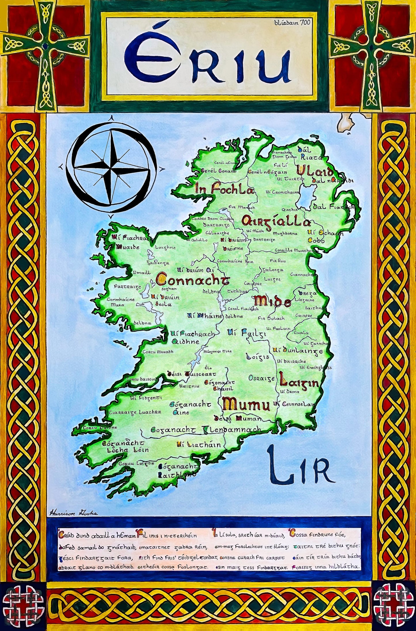
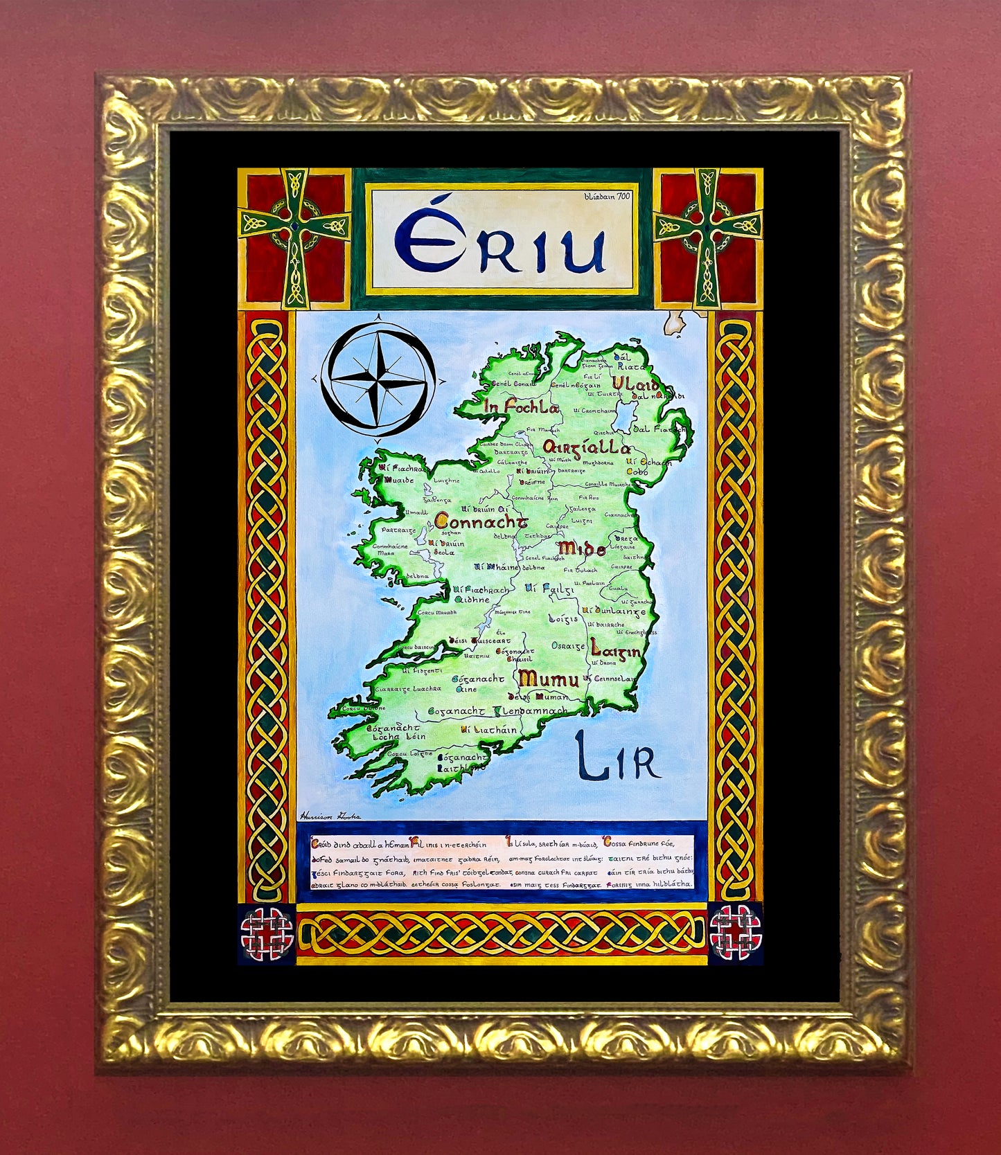
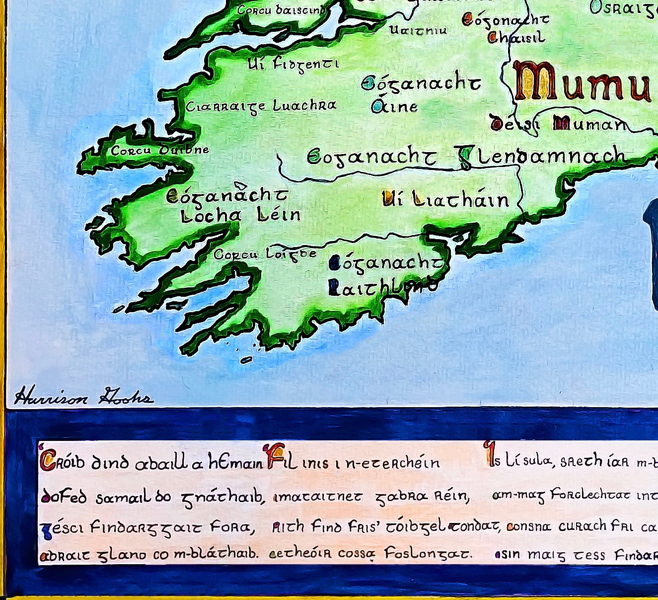
Hand-painted and researched map of Ireland around the year 700, written in Insular half-uncial (Irish majuscule) script inspired by manuscript traditions such as the Book of Kells.
The map identifies both major and minor túatha (kingdoms and clan territories) of early medieval Ireland, reflecting the island’s highly decentralized political structure. Rather than imposing later English administrative divisions, the composition reconstructs the landscape of early Gaelic lordship and regional kingship.
A passage from Immram Brain (The Voyage of Bran)—a narrative blending prose and poetry—is incorporated at the base, situating the map within Ireland’s rich early medieval literary culture. The border is framed with interlaced Celtic knotwork, Celtic crosses, and Dara knot motifs derived from Insular artistic traditions.
The result is a cartographic interpretation of Ireland before Viking urban foundations and before Anglo-Norman intervention, grounded in linguistic and artistic authenticity.
High-quality giclée print available in multiple sizes. The printed version preserves greater clarity and detail than compressed online images.
This map was researched and hand-painted by a trained historical cartographer with academic experience in European and global history. Each CartographyCraft map is designed to prioritize historical accuracy, visual clarity, and period-appropriate aesthetics over modern anachronism. If you are interested in a print with a frame or the original, contact the site owner directly.
-
Shipping
Maps are shipped sealed in a tube via UPS, USPS, and FedEx. Please allow up to 2 weeks for your map to arrive.
-
Return Policy
Not happy with the product? Full refund on returns up to 30 days after purchase.