


CartographyCraft
Kingdom of Bavaria (1806–1918) — Historical Map in Bavarian Dialect and Fraktur Script
Kingdom of Bavaria (1806–1918) — Historical Map in Bavarian Dialect and Fraktur Script
Couldn't load pickup availability
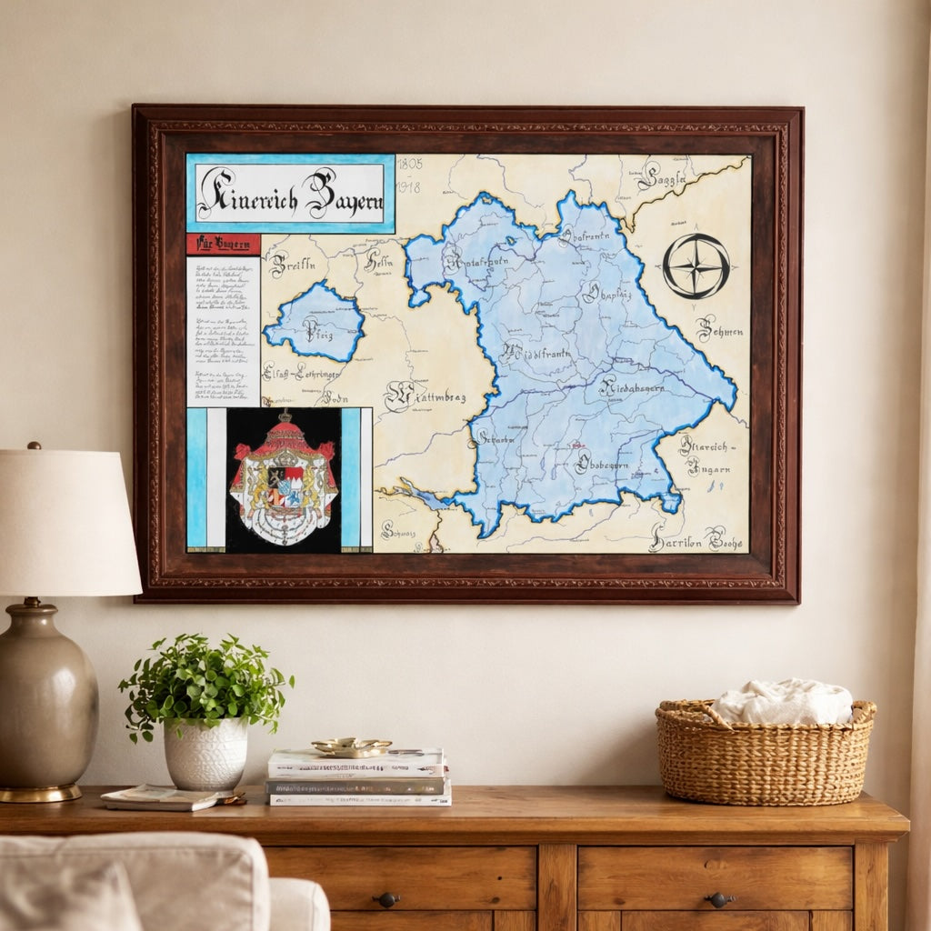
Hand-painted and historically researched map of the Kingdom of Bavaria during the nineteenth and early twentieth centuries, from its elevation to kingdom status in 1806 to the end of the monarchy in 1918.
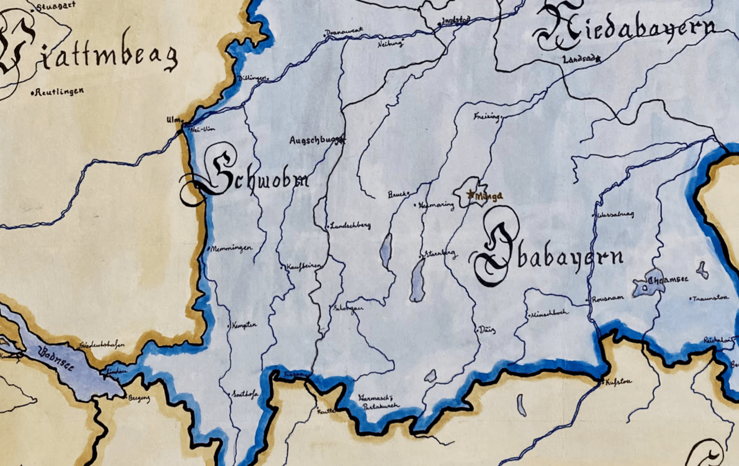
The Kingdom of Bavaria emerged in the context of the Napoleonic reordering of Central Europe and became one of the most significant German states of the nineteenth century. Elevated under Maximilian I Joseph of Bavaria during the dissolution of the Holy Roman Empire, Bavaria expanded territorially and consolidated its internal administrative regions, including Upper Bavaria, Lower Bavaria, Swabia, Franconia, and the Palatinate.
Although Bavaria joined the German Empire under Otto von Bismarck in 1871, it retained significant autonomy within the federal structure of the new Reich. Unlike smaller German states absorbed into Prussian dominance, Bavaria preserved its own military structures in peacetime, diplomatic prerogatives, and a distinct regional identity. The monarchy continued under rulers such as Ludwig II of Bavaria until the collapse of imperial Germany in 1918.
This map reflects that distinct identity not only politically but linguistically. Labels are rendered in Fraktur and incorporate elements of Bavarian dialect—such as in the rendering of Munich as “Minga”—highlighting regional speech patterns rather than standardized High German. The typographic choice reinforces the cultural and intellectual milieu of nineteenth-century southern Germany rather than projecting modern orthographic conventions backward.
Internal administrative divisions are clearly delineated, emphasizing Bavaria as a composite kingdom rather than a monolithic territory. Surrounding states—Prussia, Austria-Hungary, Württemberg, and others—are positioned to reflect Bavaria’s strategic location within the shifting balance of German and Central European politics.
Stylistically, the work draws upon nineteenth-century German cartographic aesthetics while maintaining modern legibility. Heraldic elements and decorative framing are integrated without overwhelming the political geography.
Each print is produced as a high-quality giclée reproduction that preserves the detail of the original hand-painted artwork. The physical print retains significantly greater clarity than compressed digital images.
This map was researched and created by a trained historical cartographer with academic experience in European and German political history. Every CartographyCraft piece prioritizes historical precision, linguistic authenticity, and contextual nuance over nostalgic or simplified depictions. For framed prints or inquiries regarding the original artwork, please contact the studio directly.


-
Shipping
Maps are shipped sealed in a tube via UPS, USPS, and FedEx. Please allow up to 2 weeks for your map to arrive.
-
Return Policy
Not happy with the product? Full refund on returns up to 30 days after purchase.